2025-121 Chino Hills State Park
State Parks’ Wildfire Resiliency Efforts Face Few Requirements and Limited Coordination
Published: August 18, 2026Report Number: 2025-121
August 18, 2026
2025‑121
The Governor of California
President pro Tempore of the Senate
Speaker of the Assembly
State Capitol
Sacramento, California 95814
Dear Governor and Legislative Leaders:
As directed by the Joint Legislative Audit Committee, my office conducted an audit of Chino Hills State Park’s wildfire management. Our assessment focused on the Department of Parks and Recreation’s (State Parks) policies and procedures for wildfire resilience. In general, we determined that improved coordination with neighboring entities and documentation of wildfire resilience activities could help increase Chino Hills State Park’s wildfire resilience.
We found that few wildfire resilience requirements apply to State Parks. Despite Chino Hills State Park being exempt from certain state defensible space requirements, State Parks’ policy still requires maintenance of defensible spaces. State Parks conducted some of the required activities, but State Parks could not provide complete documentation to demonstrate that it consistently completed vegetation management around Chino Hills State Park.
Various state guidance calls on State Parks to coordinate with surrounding cities and fire suppression agencies, which State Parks has planned and agreed to but has not completed. Furthermore, Chino Hills State Park’s Wildfire Management Plan could better align with best practices to ensure the wildfire resilience of the park. Finally, we determined that Southern California Edison coordinates with State Parks to complete wildfire resilience activities on the power lines in Chino Hills State Park.
Our report includes recommendations to State Parks to improve documentation practices, increase consistency of coordination, update its wildfire management plan, and determine its workforce needs. We also recommend that the Legislature amend a state grant program that may assist neighboring landowners in completing essential defensible space clearance where private and public lands meet.
Respectfully submitted,
GRANT PARKS
California State Auditor
Selected Acronyms Used in This Report
| CAL FIRE | California Department of Forestry and Fire Protection |
| CWMPA | California Wildfire Mitigation Program Authority |
| IAA | Interagency Agreement |
| LRA | local responsibility area |
| SCE | Southern California Edison |
| SRA | state responsibility area |
| WUI | wildland-urban interface |
Summary
Key Findings and Recommendations
Chino Hills State Park is a 14,000-acre publicly owned park in the Chino Hills area southeast of Los Angeles. Managed by the California Department of Parks and Recreation (State Parks) and a part of the Inland Empire District (Inland District), Chino Hills State Park is home to diverse ecosystems, as well as protected plant and animal species. Although it is under the jurisdiction of State Parks, the park itself is located in multiple counties and cities. The Joint Legislative Audit Committee requested this audit because of concerns about interagency coordination and wildfire resilience efforts—actions taken to prepare for, recover from, and reduce the risks and impacts of wildfire events—in the park. This audit responds to that request and concludes the following:
State Parks Performs Some Wildfire Resilience Activities in Chino Hills State Park but Does Not Consistently Document Them
Requirements in state law for maintaining defensible spaces do not apply to Chino Hills State Park. Nevertheless, State Parks has developed a Wildland Fire Management Plan (Wildfire Management Plan) for the park that identifies the steps it believes are necessary to maintain defensible spaces around the park’s structures. State Parks’ internal documentation provides some evidence that it performed wildfire resilience activities at various times. However, State Parks could not provide documentation that demonstrated that it consistently performed all wildfire resilience activities in accordance with the park’s Wildfire Management Plan.
Chino Hills State Park’s Wildfire Management Plan is partially based on standards set in a department-wide wildfire management plan template (template). However, because State Parks district staff are not required to use the department’s template, the park’s Wildfire Management Plan does not include some of its components. For example, the park’s Wildfire Management Plan does not include a wildfire preparedness section that the template recommends. We recommend that State Parks should consider adding aspects of the template and other best practices to Chino Hills State Park’s Wildfire Management Plan to ensure that it accurately assesses the fuels, hazards, and risks in the park.
Finally, staffing challenges have caused difficulty managing vegetation. However, the Inland District has yet to ask for additional funding or personnel.
State Parks Could Increase Collaboration With Neighboring Landowners, Local Entities, and CAL FIRE
In 2018, the State established the California Forest Management Task Force (Wildfire Task Force) to introduce an integrated approach toward effective forest management. The director of the California Natural Resources Agency and an official from the U.S. Forest Service lead the Wildfire Task Force’s executive committee. In 2021, the Wildfire Task Force published California’s Wildfire and Forest Resilience Action Plan (California’s Wildfire Plan), which set broad goals for some wildfire resilience efforts. Although the plan instructs State Parks to expand collaboration with neighboring landowners and agencies, we found that State Parks has yet to do so. For example, we noted that neighboring landowners are not applying for Boundary Vegetation Modification Right of Entry permits (vegetation permits), which grant parties permission to access State Parks’ land to conduct defensible space vegetation removal. The Inland District environmental coordinator noted that most parties who ask about vegetation permits believe that State Parks will clear the vegetation. After learning that they would have to clear the vegetation, landowners are not interested in pursuing the permit.
The California Wildfire Mitigation Program (mitigation program) provides financial assistance to homeowners in specific areas for retrofitting buildings, hardening structures, creating defensible space, and conducting vegetation management. However, Chino Hills State Park is currently not located in any of the counties selected for the mitigation program. The mitigation program is administered by the California Wildfire Mitigation Program Authority (CWMPA) under a joint powers agreement between the California Governor’s Office of Emergency Services and California Department of Forestry and Fire Protection (CAL FIRE). The CWMPA was responsible for developing criteria and a scoring methodology according to specific standards to prioritize financial assistance provided under the mitigation program to certain areas and communities. If the communities surrounding the park were included in the mitigation program, individual landowners could use the money provided to clear defensible spaces on park land near their homes to protect their properties from fires.
Additionally, although Chino Hills State Park’s Wildfire Management Plan requires State Parks to meet with local fire suppression agencies annually, district staff have not done so. State Parks staff generally attribute this shortcoming to staff vacancies. In addition, State Parks has not held or attended an interagency wildfire planning meeting with CAL FIRE to discuss Chino Hills State Park’s Wildfire Management Plan, a requirement in their Interagency Agreement. The Inland District superintendent stated that ongoing vacancies in the Chino Hills State Park manager position have presented a hurdle to holding the meeting. However, by delaying, State Parks is forgoing opportunities to identify changes in the park’s Wildfire Management Plan, to refamiliarize fire personnel with the plan, and to strengthen relationships with fire suppression personnel.
SCE Performs Wildfire Resilience Activities on Its Power Lines and Often Coordinates With State Parks
Southern California Edison (SCE) owns and maintains overhead power lines in Chino Hills State Park. There are four overhead transmission lines that cross the park and several overhead distribution lines around its perimeter. SCE performs annual vegetation clearance inspections for all of its distribution and transmission lines and manages vegetation in the park as necessary. The Office of Energy Infrastructure Safety (Energy Safety) is the agency responsible for ensuring that electrical corporations such as SCE are reducing their wildfire risk and adhering to their approved wildfire mitigation plans. In its most recent annual report on compliance for SCE, published in 2025, Energy Safety found that SCE met 90 percent of its 2023 Wildfire Mitigation Plan initiative targets in 2023. On a visit to the park in May 2026, we observed that vegetation clearance from power lines generally followed state law.
To address our findings, we have made recommendations to the Legislature and State Parks. We recommend that the Legislature could consider amending state law to expand the mitigation program eligibility areas to include all properties that contain a habitable structure within 130 feet of Chino Hills State Park’s land and that are within the mitigation program’s eligible designated wildfire hazard areas. Additionally, we recommend that State Parks systematically document and report the specific wildfire resilience activities it performs in Chino Hills State Park. Further, we recommend that State Parks update the park’s Wildfire Management Plan to reflect relevant practices and that it organize prescribed meetings with local fire suppression agencies, CAL FIRE, and local governments. Finally, we recommend that State Parks analyze the Inland District’s maintenance workforce needs and submit a budget change proposal to the Legislature to request those personnel.
Agency Comments
State Parks agreed with most of our recommendations, including those related to documenting wildfire resilience activities at Chino Hills State Park and publicly communicating those efforts. State Parks provided some additional context for recommendations related to the park’s Wildfire Management Plan and how State Parks staff coordinate with other agencies near the park, including CAL FIRE.
Introduction
Background
State Parks’ purpose is to preserve outstanding natural, scenic, and cultural values, indigenous aquatic and terrestrial fauna and flora, and the most significant examples of ecological regions of California. It manages the largest natural and cultural heritage holdings of any state agency in the nation, with over 1.6 million acres that are divided into 280 state parks and organized into 21 districts.
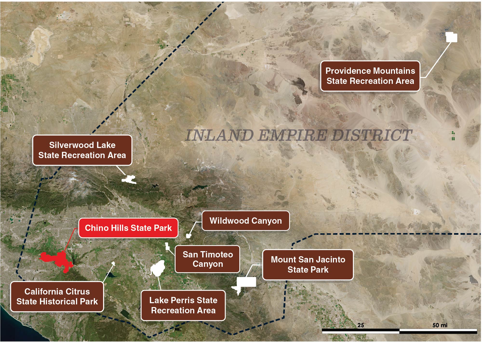
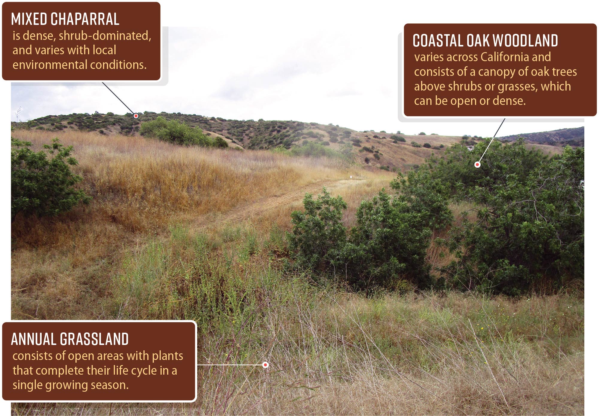
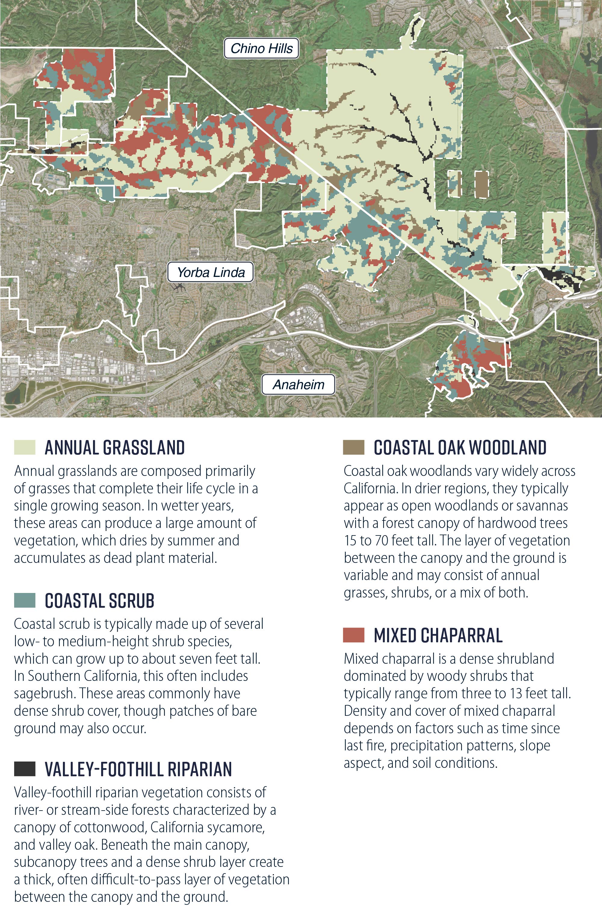
Chino Hills State Park, which at over 14,000 acres is the 18th largest in the State, resides in the Inland District, which Figure 1 depicts. As a critical link in the Puente-Chino Hills biological corridor, the park effectively enlarges habitats by linking its plants and animals to other open spaces. The park is home to diverse ecosystems, including chaparral, grasslands, and woodlands, as well as to protected species, such as the Least Bell’s Vireo and the Coastal California Gnatcatcher. Several hundred acres of walnut woodlands are also preserved in the park, which is a significant portion of only a few thousand acres that still exist. Figure 2 depicts the park’s diverse ecosystems, and Figure 3 depicts their dispersion throughout the park. The park has more than 90 miles of trails, a campground, picnic areas, equestrian facilities, a visitor center, a historic barn, and historic cattle equipment.
Figure 1
Chino Hills State Park Is One of Eight Parks and Properties Managed by the Inland District
Source: Auditor-generated using State Parks and Copernicus Sentinel [2026] data.
Note: Sentinel-2 is a European mission consisting of two satellites used to monitor land surface changes, which is made available free of charge to all data users, including the public, scientific, and commercial users for support of services including land monitoring, risk mapping, and forestry.
Figure 1 shows all parks in State Parks’ Inland District: Providence Mountains State Recreation Area, Silverwood Lake State Recreation Area, Wildwood Canyon, San Timoteo Canyon, Chino Hills State Park, California Citrus State Historic Park, Lake Perris State Recreation Area, and Mount San Jacinto State Park. It includes a note that says “Sentinel-2 is a European mission consisting of two satellites used to monitor land surface changes, which is made available free of charge to all data users, including the public, scientific, and commercial users for support of services including land monitoring, risk mapping, and forestry.” This figure shows that the parks in this district are spread out across Southern California.
Figure 2
Chino Hills State Park Consists of Multiple Varieties of Plant Communities
Source: Auditor observation, State Parks documentation, and CAL FIRE data.
Figure 2 shows an annotated photo of the park. The photo depicts a landscape featuring a hill with various forms of plants, including mixed-chaparral, coastal oak woodland, and annual grassland. Text on the image states, “Mixed chaparral is dense, shrub-dominated, and varies with local environmental conditions. Coastal oak woodland varies across California and consists of a canopy of oak trees above shrubs or grasses, which can be open or dense. Annual grassland consists of open areas with plants that complete their lifecycle in a single growing season.”
Figure 3
Chino Hills State Park Contains Many Unique Habitat Types With Substantial Portions of Habitats Threatened by Wildfire Located Near Communities
Source: Auditor-generated using CAL FIRE, State Parks and Copernicus Sentinel [2026] data.
Figure 3 shows five different vegetation types and their locations in the park. It describes annual grasslands: “Annual grasslands are composed primarily of grasses that complete their life cycle in a single growing season. In wetter years these areas can produce a large amount of vegetation, which dries by summer and accumulates as dead plant material.” It describes coastal woodlands: “Coastal oak woodlands vary widely across California. In drier regions, they typically appear as open woodlands or savannas with a forest canopy made up of hardwood trees 15 to 70 feet tall. The layer of vegetation between the canopy and the ground is variable and may consist of annual grasses, shrubs, or a mix of both.” It describes coastal scrub: “Coastal Scrub is typically made up of several low to medium sized shrub species, which can grow up to about seven feet tall. In Southern California, this often includes species of sagebrush. These areas commonly have dense shrub cover, though patches of bare ground may also occur.” It describes mixed chaparral: “Mixed chaparral is a dense shrubland dominated by woody shrubs that typically range from three to 13 feet tall. Density and cover of mixed chaparral depends on factors such as time since the last fire, precipitation patterns, slope aspect, and soil conditions.” It describes Valley-foothill riparian: “Valley-foothill riparian vegetation consists of river or stream side forests characterized by a canopy of cottonwood, California sycamore, and valley oak. Beneath the main canopy, subcanopy trees and a dense shrub layer create a thick, often difficult to pass layer of vegetation between the canopy and the ground.” This figure shows there are different types of habitats spread throughout different parks of the park.
A district-level State Parks superintendent oversees managers in the Inland District as well as district-wide natural resources and facilities development programs. A senior environmental scientist leads the Inland District’s Natural Resources program and oversees both district-wide and sector-specific environmental scientists. The Natural Resources Division at State Parks’ headquarters is responsible for providing overall leadership and direction to State Parks’ natural resources management program, including systemwide planning, natural resource program management, preparation of policy and guidelines, and service to the districts. The division also oversees State Parks’ compliance with the California Environmental Quality Act.
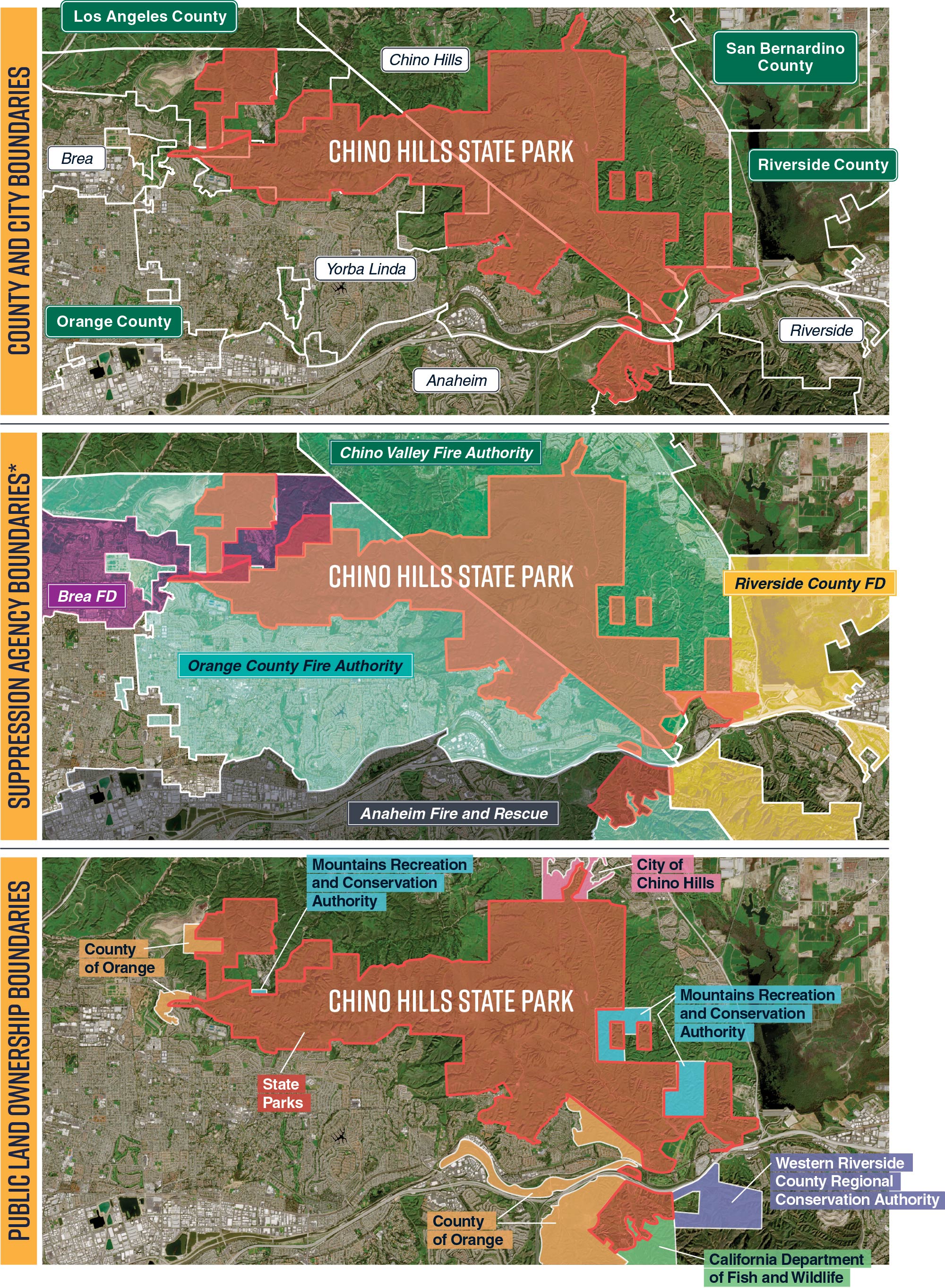
Chino Hills State Park is located among a substantial number of local jurisdictions, as Figure 4 shows. Although the park’s land is under the jurisdiction of State Parks, the park is situated in the counties of Orange, Riverside, and San Bernardino, and it is adjacent to Los Angeles County. The park is bordered on the north by the city of Chino Hills, on the south by the city of Yorba Linda, and on the west by the city of Brea. The local fire suppression agencies for these entities are Chino Valley Fire District, Orange County Fire Authority, and Brea Fire, respectively. There are also transmission lines in the park that are owned and operated by SCE, and overhead distribution lines, which service surrounding neighborhoods.
Figure 4
Chino Hills State Park Is in a Location With Multiple Jurisdictions and Landowners
Source: Auditor-generated using CAL FIRE, U.S. Census Bureau, State Parks, and Copernicus Sentinel [2026] data.
Note: In the third map, any land not classified is generally privately owned land.
* CAL FIRE is the primary fire suppression agency for State Parks. CAL FIRE shares responsibility for wildland fires with Chino Valley Fire District in the San Bernardino County and Riverside County portions of the park, and with Orange County Fire Authority in the Orange County portions of the park. Suppression of structural fires within the park is the responsibility of Chino Valley Fire District in San Bernardino County and Brea Fire Department in Orange County.
Figure 4 shows three maps of the park and nearby boundaries: one map of cities’ and counties’ boundaries near the park, one map of suppression agencies’ boundaries near the park, and one map of public land ownership boundaries near the park. The first map shows Los Angeles, Orange, Riverside, and San Bernadino County near the park. It also shows the cities of Chino Hills, Brea, Yorba Linda, Anaheim, and Riverside near the park. The second map shows Brea Fire Department, Placentia Fire Department, Anaheim Fire and Rescue, Orange County Fire Authority, Corona Fire Department, Riverside County Fire Department, Chino Valley Fire Authority, and Los Angeles Fire Department near the park. The third map shows State Parks, County of Orange, Mountains Recreation and Conservation Authority, California Department of Fish and Wildlife, City of Chino Hills, and Western Riverside County Regional Conservation authority as public land owned near the park. This map also contains a note that says “in the third map, any land not classified is generally privately owned.” This figure shows there are many different entities, and different types of entities, near the park. Lastly, a second note states, “CAL FIRE is the primary fire suppression agency for State Parks. CAL FIRE shares responsibility for wildland fires with Chino Valley Fire District in the San Bernadino County and Riverside County portions of the park, and with Orange County Fire Authority in the Orange County portions of the park. Suppression of structural fires within the park is the responsibility of Chino Valley Fire District within San Bernadino County and Brea Fire Department within Orange County.”
Climate and Land Use Change’s Effects on Wildfires and Mitigation
Wildfires are a natural part of California’s landscape, but climate change increasingly exposes homes to fire’s destructive potential. Since the 1980s, lengthening fire seasons and more frequent, longer, and more severe droughts have increased the area burned by wildfires. Furthermore, enabled by warmer and drier summer weather, extreme fire weather is more frequently occurring in multiple locations at once, creating favorable conditions for wildfire across large geographies. Recent research also points to the danger of whiplash, where periods of wet weather allow fuel build‑up that rapidly dries during later dry periods, contributing to extreme fire behavior, especially during high winds.1
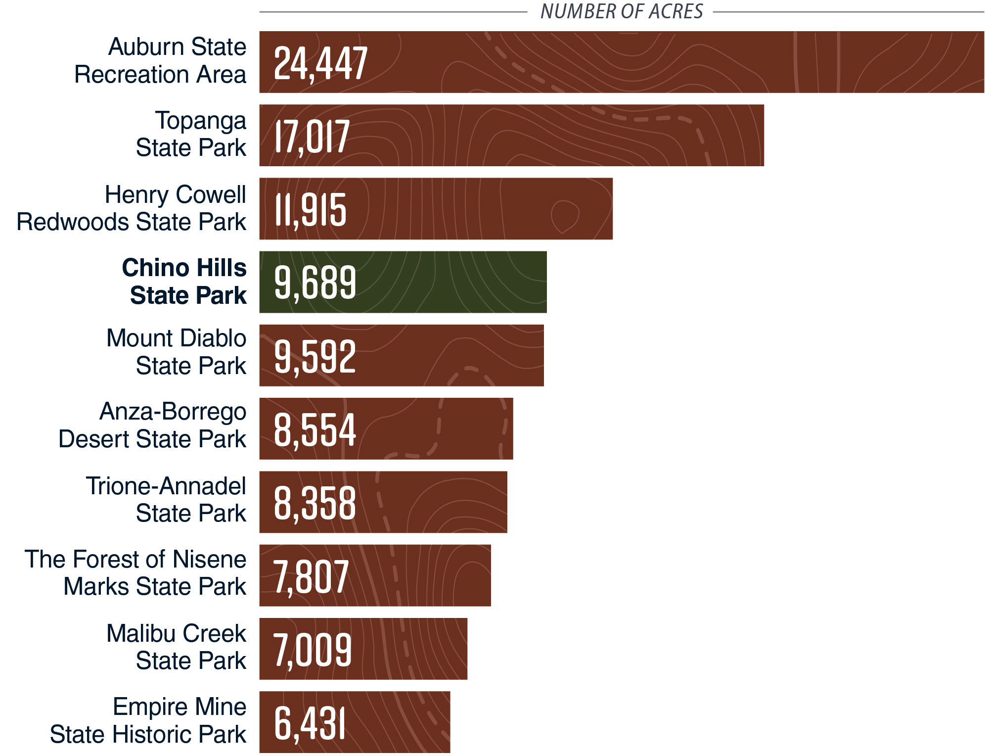
Additionally, the number of homes built in the wildland-urban interface (WUI) has grown substantially, which causes more frequent wildfire ignition near homes and exposes more homes to wildfires when they occur. The WUI—a zone of transition between human development and unoccupied wildland where structures meet with undeveloped wildland or vegetative fuels—is a difficult and potentially dangerous environment for firefighting because fire fighters are typically trained to fight either structural or wildland fires, but rarely both. According to one study from 2019, 82 percent of structures destroyed by wildfire in California are in the WUI.2 Consequently, resource managers in these areas face the challenge of balancing the needs of natural resources in the wildland with the intense social pressure to mitigate risks and losses in communities. As Figure 5 shows, Chino Hills State Park has the fourth-largest land area classified as having housing adjacent to or interspersed within vegetation within two kilometers of park borders, excluding parks predominantly composed of water bodies such as lakes.
Figure 5
Within the State Park System, Chino Hills State Park Has the Fourth-Largest Land Area Where Housing is Adjacent to or Interspersed With Vegetation Within Two Kilometers of Its Borders
Source: Auditor-generated using CAL FIRE and State Parks data.
Note: This figure represents only the top ten parks in the State Parks system with the most land where housing is adjacent to, or interspersed with, vegetation within two kilometers of park borders. Other parks in the State Parks system have land where housing is adjacent to, or interspersed with, vegetation within two kilometers of park borders that are not represented in this figure.
Figure 5 shows a vertical bar graph comparing the amount of land where housing is adjacent to or interspersed in vegetation within two kilometers of a state park’s borders. The x-axis ranges from zero to 30 thousand acres, and the y-axis lists the following State Parks in order of acreage: Auburn SRA, Topanga SP, Henry Cowell Redwoods SP, Chino Hills SP, Mount Diablo SP, Anza-Borrego Desert SP, Trione-Annadel SP, The Forest of Nisene Marks SP, Malibu Creek SP, and Empire Mine SHP. A note at the bottom of the figure reads, “This figure represents only the top ten parks in the State Parks system with the most land where housing is adjacent to, or interspersed with, vegetation within two kilometers of park borders. Other parks in the State Parks system have land where housing is adjacent to, or interspersed with, vegetation within two kilometers of park borders that are not represented in this figure.” The figure shows that Auburn SRA has the most land in this area, and Chino Hills State Park has the fourth most land in this area.
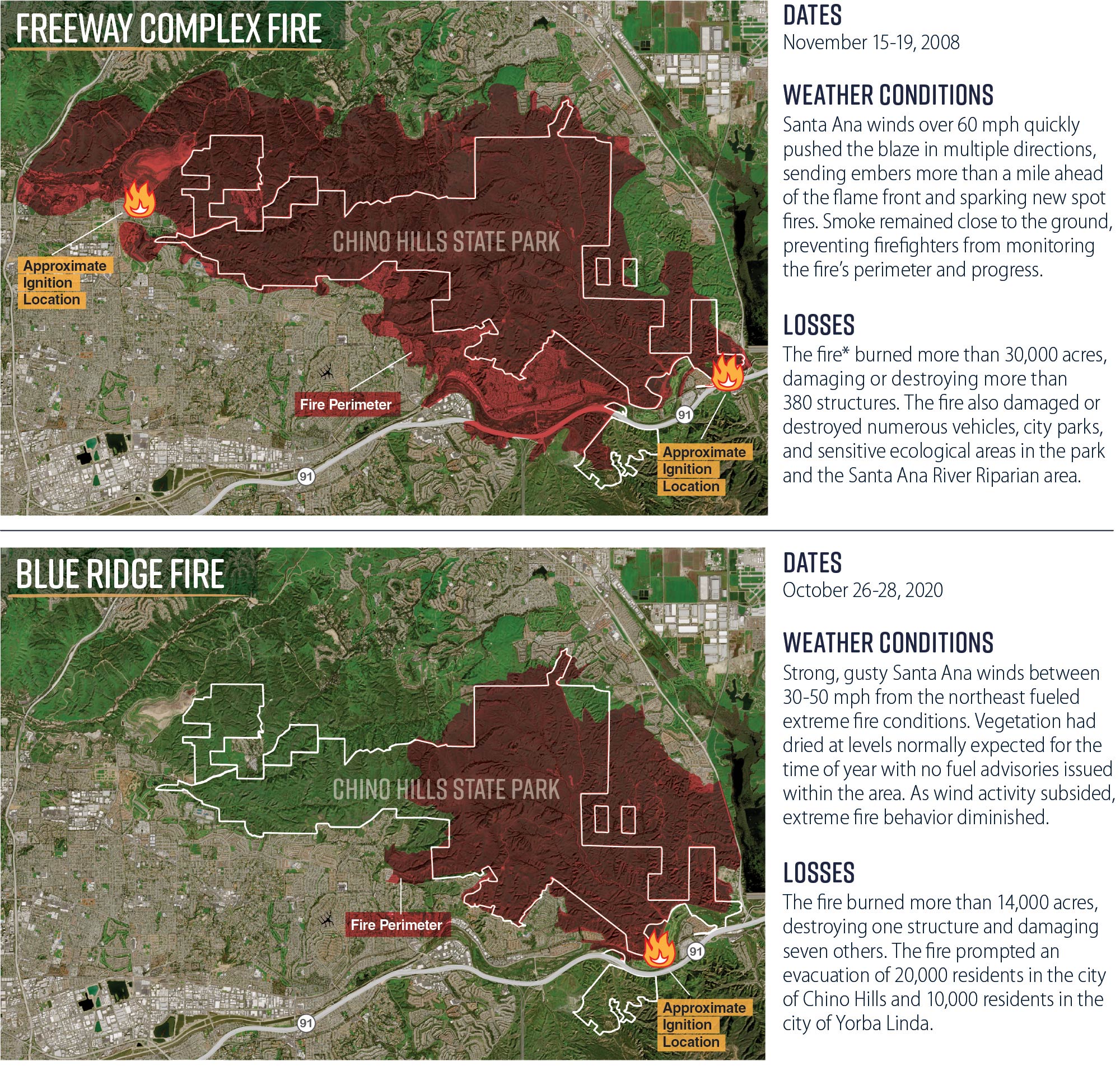
CAL FIRE data and local research have noted that since 2012, or in the past 14 years, there have been more than 50 fires in or around Chino Hills State Park; in the 98 years prior to 2012, only 103 fires were recorded in this area. Research on the historical patterns of wildfire ignition in California has found that human activity causes more than 96 percent of the fires in Southern California.3 As we show in Figure 6, Chino Hills State Park has a history of significant fires, including the 2008 Freeway Complex Fire that burned 95 percent of the park and the 2020 Blue Ridge Fire that burned over 60 percent of the park. Both fires ignited near the park’s borders in areas that include the Brea Alpha landfill and the 91 Freeway. In an after-action report on the Freeway Complex Fire, the Orange County Fire Authority attributed the fire’s intensity to several years of drought that dried vegetation, and it attributed the fire’s rapid spread to the area’s topography and Santa Ana winds of more than 60 miles per hour. The after-action report noted that the majority of WUI properties in surrounding communities had complied with defensible space and fuel modification requirements before the fire.
Figure 6
Two Fires Have Burned Through Chino Hills State Park and Into Surrounding Communities—Both Driven by Santa Ana Winds
Source: Auditor-generated using CAL FIRE, State Parks, and Copernicus Sentinel [2026] data; CAL FIRE and Orange County Fire Authority reporting; and auditor research.
* The Freeway Complex Fire was a combination of the Brea Landfill Fire, which started near the Olinda Alpha Landfill, and the Freeway Fire, which started near the westbound 91 Freeway and Green River.
Figure 6 shows two maps of Chino Hills State Park and the approximate fire ignition locations and fire perimeters from the Freeway Complex Fire and Blue Ridge Fire. The first map shows the Freeway Complex Fire which occurred from November 15th through 19th in 2008. It describes the weather conditions: “Santa Ana winds over 60 mph pushed the blaze in multiple directions, sending embers more than a mile ahead of the flame front and sparking new spot fires. Smoke remained close to the ground preventing firefighters from monitoring the fire’s perimeter and progress.” It also describes the losses: “The fire burned more than 30,000 acres, damaging and destroying more than 380 structures. The fire also damaged and destroyed numerous vehicles, city parks, and sensitive ecological areas in the park and the Santa Ana River Riparian area.” The figure contains a note that says, “The Freeway Complex Fire was a combination of the Brea Landfill Fire, which started near the Olinda Alpha Landfill, and the Freeway Fire, which started near the westbound 91 Freeway and Green River.” The second map shows the Blue Ridge Fire which occurred from October 26th through 28th 2020. It describes the weather conditions: “Strong, gusty Santa Ana winds between 30-50 mph from the northeast fueled extreme fire conditions. Vegetation had dried at levels normally expected for the time of year with no fuel advisories issued within the area. As wind activity subsided, extreme fire behavior diminished.” It describes the losses: “The fire burned more than 14,000 acres, destroying one structure and damaging seven others. The fire prompted an evacuation of 20,000 residents in the city of Chino Hills and 10,000 residents in the city of Yorba Linda.” This figure shows that these two fires started outside the park’s border, and traveled through a significant portion of the park.
Increased Difficulties With Suppression Efforts
Simultaneous extreme fire weather across a large geography is increasingly straining the resources of fire suppression agencies. In a report on the 2020 fire season—one of the worst fire years in California—CAL FIRE recounted how state fire suppression resources were stretched to their limits as fires burned up and down the State. During that fire season, 28 civilians and three firefighters lost their lives while wildfire destroyed over 9,000 structures and burned 4.2 million acres in California. The strain on fire suppression resources that a fire season can cause and the danger posed by extreme, simultaneous fire weather makes wildfire resilience activities increasingly important for addressing wildfire risk.
Wildfire resilience refers to a suite of actions taken to prepare for, recover from, and reduce the risks and impacts of wildfire events. Wildfire resilience activities, which we describe in the text box, could include fuel reduction in the WUI, the creation and maintenance of fuel breaks, and efforts to ecologically restore landscapes. Although fuel breaks can help firefighters to establish control perimeters when fires are wind-driven, fuel breaks are not generally effective in extreme wind and weather conditions that cause embers to be carried over fuel breaks.
Examples of Wildfire Resilience Activities
Wildfire resilience activities can include the following:
- Fuel reduction in the WUI, which consists of reducing the density of vegetation to directly protect communities and assets from potential damage from wildfires that are not wind-driven that originate in adjacent wildland.
- The creation and maintenance of fuel breaks, which consists of the total or partial removal of vegetation in strategic locations to allow firefighters access to control wildfires or to slow fires that are not wind-driven.
- Ecological restoration, which consists of using vegetation treatments to bring the landscape closer to native conditions where natural fire processes can be reestablished and habitat quality is improved. This includes remediating habitats where nonnative, invasive plants have spread or excess fire fuel has accumulated.
Source: California Board of Forestry and Fire Protection.
A 2018 gubernatorial executive order and subsequent legislation established the Wildfire Task Force to introduce a holistic and integrated approach toward effective forest management. Led by the director of the California Natural Resources Agency and an official from the U.S. Forest Service, the Wildfire Task Force published California’s Wildfire Plan in January 2021. Several interagency workgroups, with participants from a range of California state agencies—including State Parks—are working to accomplish the key deliverables in the plan, to align agency activities, and to identify and resolve issues. The plan sets broad goals for increasing the pace and scale of forest health projects, strengthening protection of communities, managing forests to achieve the State’s economic and environmental goals, and driving innovation and measuring progress in wildfire resilience and forest management. For example, these broad goals include increasing assistance programs and partnerships between state agencies and local communities to reduce risk, improve preparedness, and foster resilience. State law requires that the Wildfire Task Force update California’s Wildfire Plan every five years. The Wildfire Task Force released a public draft of the 2026-2031 version of California’s Wildfire Plan in June 2026.
Chino Hills State Park’s Designation as a High Fire Hazard Zone
State law divides the State into state responsibility areas (SRAs) and local responsibility areas (LRAs). SRAs are areas where the State is financially responsible for preventing and suppressing fires. LRAs are areas where preventing and suppressing fires is not primarily the financial responsibility of the State or a federal agency. LRAs include incorporated cities, urban regions, agricultural lands, and portions of the desert where local governments are responsible for wildfire protection. The local governments typically provide this fire protection through city fire departments, fire protection districts, counties, or contracts with CAL FIRE.
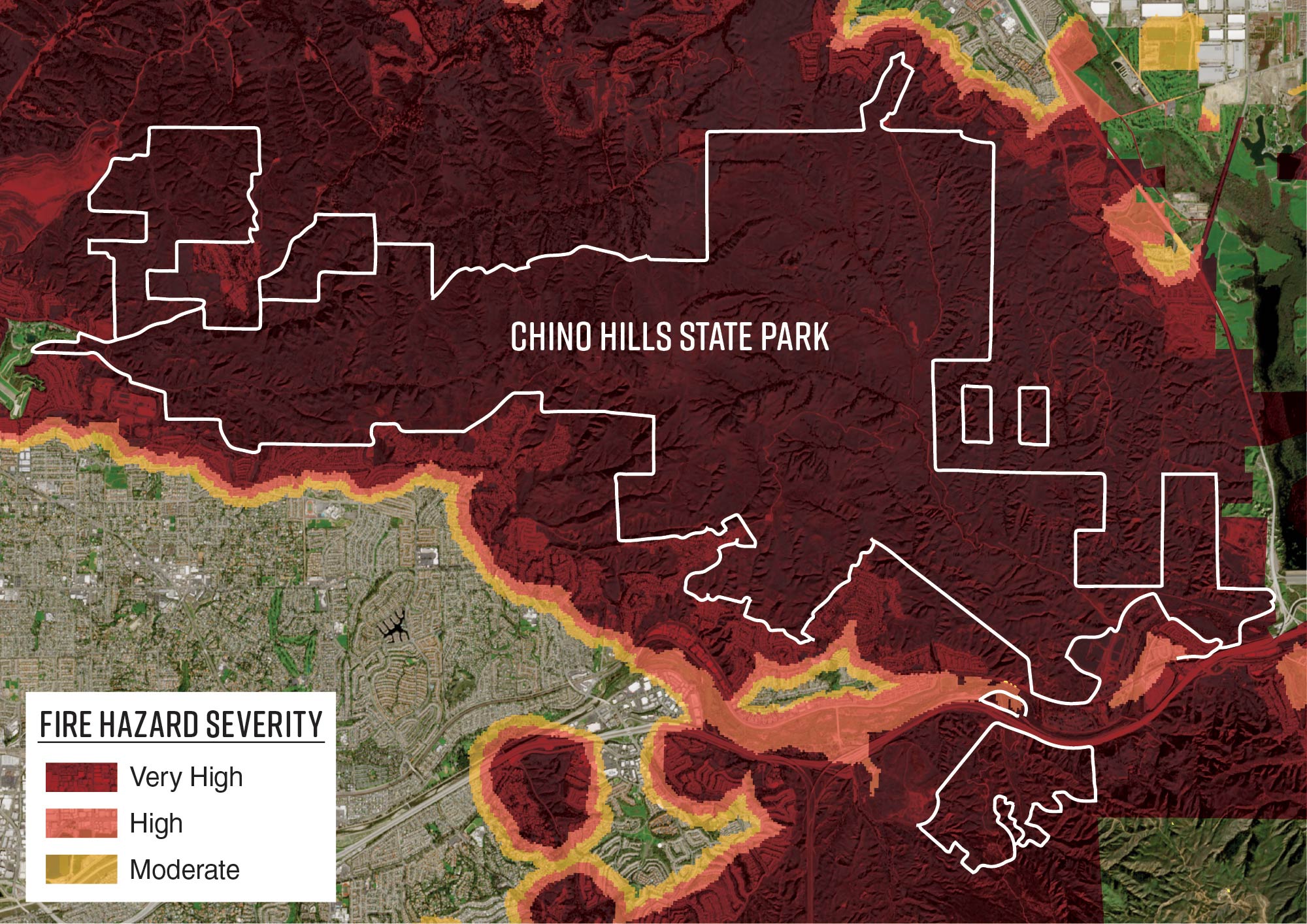
CAL FIRE also designates Fire Hazard Severity Zones (severity zones), which measure the level of wildfire hazard from moderate, high, to very high severity throughout the State. State law requires that CAL FIRE base the level of hazard in a severity zone on the amount of fuel, slope, and fire weather present while also accounting for areas where it has identified wind or other factors as a major cause of wildfire spread. We show Chino Hills State Park’s severity zones in Figure 7.
Figure 7
Over 99 Percent of Chino Hills State Park Is Located in a Very High Fire Hazard Severity Zone
Source: Auditor-generated using CAL FIRE, State Parks, and Copernicus Sentinel [2026] data.
Figure 7 shows a map of the fire hazard severity zones around the park: very high, high, and moderate fire hazard severity zones. The figure illustrates that almost the entire park is in a very high fire hazard severity zone.
SRAs and LRAs have different processes for designating severity zones. In SRAs, CAL FIRE designates and periodically reviews severity zones, revising zones or their ratings as necessary. In the LRA, CAL FIRE provides recommended severity zones to local agencies, which are required by state law to implement the recommended severity zones by ordinance within 120 days. The ordinance may increase, but may not decrease, the level of severity zone identified by CAL FIRE. CAL FIRE provided new maps of the severity zones in SRAs in 2024 and in LRAs in 2025. These new maps increased the amount of the State classified as very high hazard severity by about 35 percent, or about 4.7 million acres.
CAL FIRE determines hazard severity using different procedures for wildland and non‑wildland zones. In wildland zones, CAL FIRE identifies hazard severity by estimating the probability of an area burning and the expected flame length under worst-case fire weather conditions. In non-wildland zones, CAL FIRE identifies hazard severity by simulating ember production and dispersal from wildland within transport distance to non-wildland zones while accounting for the favorability of non-wildland zones to ignition and fire spread.
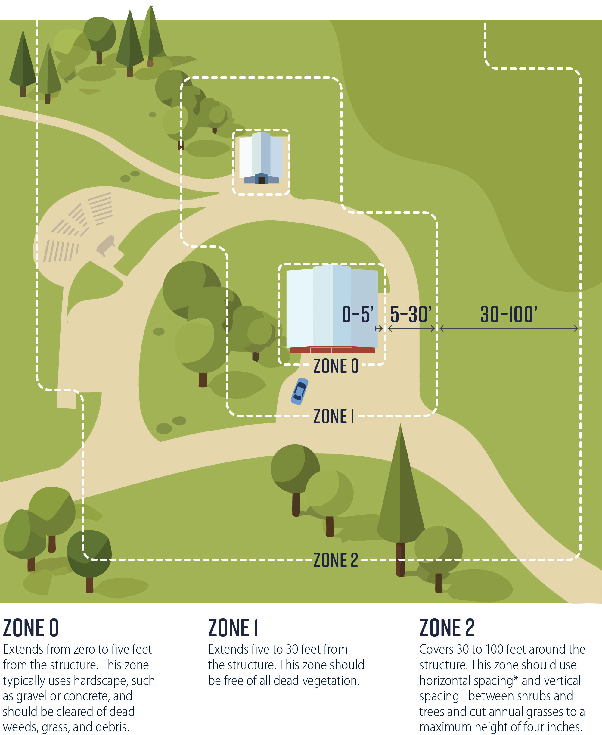
Structures and communities located in severity zones are subject to stricter requirements in state law for wildfire mitigation. The severity of the requirements depends on whether the area is located in an SRA or an LRA, as well as the hazard severity. For example, state law requires all structures located in SRAs and occupied structures in very high severity zones in LRAs to adhere to certain defensible space requirements. Figure 8 shows these defensible space requirements, which mandate vegetation maintenance within 100 feet of a habitable structure.
Figure 8
State Law Requires Defensible Spaces to Have More Intense Vegetation Management Closer to Structures
Source: State law and CAL FIRE’s website.
Note: Legislation requires CAL FIRE to adopt regulations specifying the requirements for Zone 0. As of April 2026, regulations have been drafted but have not been finally approved.
* Horizontal spacing depends on the slope of the land and the height of the vegetation. In general, there should be more space between vegetation on bigger slopes. For example, for a mild slope of less than 20 percent, horizontal spacing should be two times the height of the shrub. However, for a moderate to steep slope of greater than 40 percent, horizontal spacing should be six times the height of the shrub.
† Vertical spacing means that there should be space between the lowest tree branches and the ground or shrubs. Vertical spacing includes removing all tree branches at least six feet from the ground and keeping at least three times the height of any shrubs between the shrubs and the lowest branches of trees. For example, if a five-foot shrub is growing near a tree, there should be 15 feet of clearance between the top of the shrub and the lowest tree branch.
Figure 8 shows a cartoon graphic of an aerial view of a structure with annotated perimeters of surrounding defensible space zones. The top of the image is labeled “Defensible Space Zone Example Around a Structure”. The structure is in the center of the graphic, with “Zone 0” closest to it. A text box says “Zone 0 extends from zero to five feet from the structure. This zone typically uses hardscape, such as gravel or concrete, and should be cleared of dead weeds, grass, and debris.” This figure contains a note that says, “Legislation requires CAL FIRE to adopt regulations specifying the requirements for Zone 0. As of April 2026, regulations have been drafted but have not been finally approved.” The next closets zone, “Zone 1”, is accompanied by a text box that says, “Zone 1 extends five to 30 feet from the structure. This zone should be free of all dead vegetation.” The furthest zone, “Zone 2”, is accompanied by a text box that says, “Zone 2 covers 30 to 100 feet around the structure. This zone should use horizontal spacing* and vertical spacing** between shrubs and trees and cut annual grass to a maximum height of four inches.” This text box points to two clarification notes that say, “*Vertical spacing means that there should be space between the lowest tree branches and the ground or shrubs. Vertical spacing includes removing all tree branches at least six feet from the ground and keeping at least three times the height of any shrubs between the shrubs and the lowest branches of trees. For example, if a five-foot shrub is growing near a tree, there should be 15 feet of clearance between the top of the shrub and the lowest tree branch.” and “**Horizontal spacing depends on the slope of the land and the height of the vegetation. In general, there should be more space between vegetation on bigger slopes. For example, for a mild slope of less than 20 percent, horizontal spacing should be two times the height of the shrub. However, for a moderate to steep slope of greater than 40 percent, horizontal spacing should be six times the height of the shrub.” This figure illustrates that vegetation management is typically more intense in zones closer to the structure, such as “Zone 0”.
Audit Results
- State Parks Performs Some Wildfire Resilience Activities in Chino Hills State Park but Does Not Consistently Document Them
- State Parks Could Increase Collaboration With Neighboring Landowners, Local Entities, and CAL FIRE
- SCE Performs Wildfire Resilience Activities on Its Power Lines and Often Coordinates With State Parks
State Parks Performs Some Wildfire Resilience Activities in Chino Hills State Park but Does Not Consistently Document Them
Key Points
- Although Chino Hills State Park is not required to maintain defensible spaces and is subject to state and federal conservation laws limiting removal of some vegetation, the California Department of Parks and Recreation (State Parks) still makes efforts to maintain defensible spaces around the structures in the park.
- State Parks was not able to demonstrate that it performs the wildfire resilience activities outlined in Chino Hills State Park’s Wildland Fire Management Plan (Wildfire Management Plan) because it does not systematically document and report all its wildfire resilience activities. However, we saw evidence of vegetation management in May 2026 when we visited the park.
- Although district staff use professional judgment when creating wildfire management plans, State Parks should consider adding several department-wide and federal best practices to Chino Hills State Park’s Wildfire Management Plan. Despite the park being surrounded by wildland-urban interface (WUI), its Wildfire Management Plan lacks a section evaluating and describing wildfire hazards in the WUI that can endanger neighboring properties.
- State Parks’ staffing challenges hinder its ability to complete wildfire resilience activities as prescribed in Chino Hills State Park’s Wildfire Management Plan. Filling staff vacancies and adding additional staff positions may improve the park’s wildfire resilience efforts.
Few Requirements Exist Regarding State Parks’ Wildfire Resilience Activities
Requirements for wildfire resilience activities in state law, such as maintaining defensible spaces, do not apply to Chino Hills State Park. State law generally requires that structures in a state responsibility area (SRA) have a defensible space of 100 feet maintained from each side of the structure. However, this state law applies to private individuals and organizations, not public agencies such as State Parks. State law also provides exemptions from these requirements in very high Fire Hazard Severity Zones (severity zones), as the text box describes. Because State Parks is a public agency and because the State acquired the land comprising the park for preservation purposes, State Parks is not required by law to maintain defensible spaces around its structures in the park.
Areas Exempt From Defensible Space Requirements
Defensible space requirements for structures in very high severity zones do not apply to land managed for the following uses:
- Habitat for endangered or threatened species, or any species that is a candidate for listing as an endangered or threatened species by the state or federal government.
- Lands kept in a predominantly natural state as habitat for wildlife, plant, or animal communities.
- Open space lands that are environmentally sensitive parklands.
- Other lands having scenic values, as declared by the local agency, or by state or federal law.
Source: State law.
State Parks must also comply with state laws related to conservation. Chino Hills State Park’s internal guidance states that State Parks should not remove trees in the riparian corridor because to do so without a permit is a violation of state law. This guidance may limit some defensible space activities, such as removing vegetation. Additionally, the park’s internal guidance says that some road grading or repairs require environmental compliance with the California Environmental Quality Act or permits from regulatory agencies.
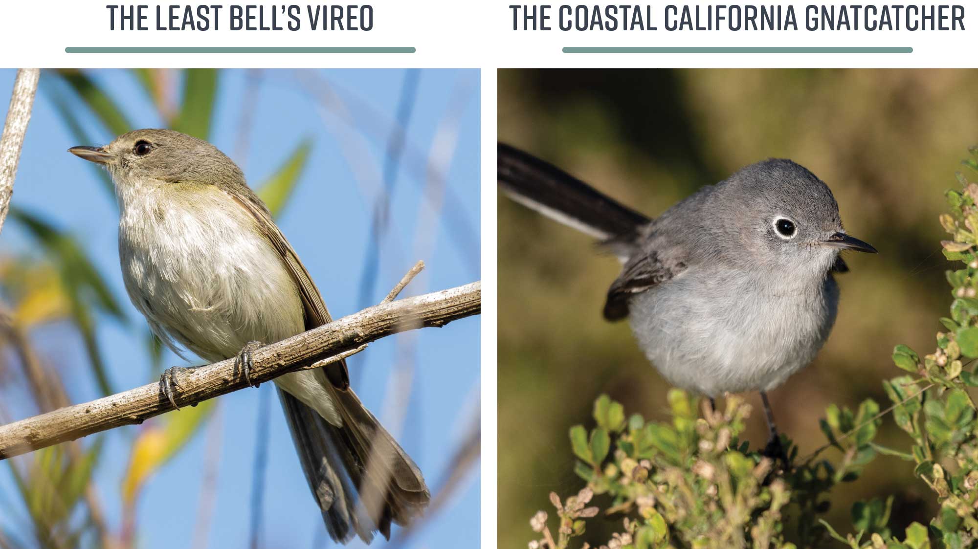
Federal law, state law, and Chino Hills State Park’s Wildfire Management Plan also have requirements for conservation that relate to wildfire resilience activities. These rules protect specific animal and plant species from being harmed or killed, including during wildfire resilience activities. For example, the park contains nesting habitat for the Least Bell’s Vireo, a small migratory bird that Figure 9 depicts. The Least Bell’s Vireo is listed as an endangered species by the U.S. Fish and Wildlife Service. Federal law says that it is unlawful for any person to harm any endangered species of wildlife. The park’s internal guidance says that the Least Bell’s Vireo is highly sensitive to noise and will abandon its nest if subject to noises over 60 decibels, resulting in harm to the bird. As a result, State Parks may limit some wildfire resilience activities that cause noise to avoid harming this species of bird.
Figure 9
Chino Hills State Park Is Home to Protected Species, Including the Least Bell’s Vireo and the Coastal California Gnatcatcher
Source: Federal law, U.S. Fish and Wildlife Service’s website, and the park’s documentation.
Figure 9 shows two images of birds. On the left, there is a photo of a small olive-gray bird on a branch titled “The Least Bell’s Viero”. On the right, there is a photo of small blue-gray bird on a leafy branch titled “The Coastal California Gnatcatcher.” This figure shows the faces of two protected species that inhabit the park.
Although it is not legally required to do so, State Parks still makes efforts to maintain defensible spaces around the structures in the park. The park’s Wildfire Management Plan, which we discuss in the next section, outlines these wildfire resilience efforts.
State Parks Lacks Records to Consistently Demonstrate Its Compliance With Chino Hills State Park’s Vegetation Management Policies
Chino Hills State Park’s Wildfire Management Plan contains guidance for specific wildfire resilience activities. For example, the plan lists tasks for maintaining defensible space zones around structures, such as clearing dead trees and cutting dead limbs off vegetation. In another example, the Wildfire Management Plan says State Parks should mitigate grass vegetation annually in defensible space zones. According to the Inland District superintendent, State Parks staff collaboratively assess the need for wildfire resilience activities, such as vegetation management, around the park’s structures based on observation during daily activities and on changing conditions, such as weather. The text box describes examples of vegetation management. State Parks provided evidence that it performs some wildfire resilience activities in the park, as we show in Table 1.
Examples of Methods of Vegetation Management
- Thinning, pruning, and clearing vegetation.
- Creating defensible spaces around structures.
- Using herbicide.
- Mowing.
Source: The California Governor’s Office of Emergency Services website.
Documentation of Activities
State Parks’ internal documentation shows that it performed wildfire resilience activities, such as vegetation abatement and herbicide spraying, at varying time intervals between 2024 and early 2026. However, this documentation confirms only that the activities occurred rather than specifying whether the activities were done in accordance with the park’s Wildfire Management Plan. For example, State Parks’ documentation includes logs for two dates in April 2025. The logs include the name of the employee who performed the work, the date of the activity, and any pertinent notes. Although the two logs record vegetation management around Chino Hills State Park’s structures, neither log notes measurements to verify that the vegetation was cut to lengths specified in the park’s Wildfire Management Plan. In another example, the park’s documentation includes sporadic reports of herbicide use to manage vegetation around the park’s structures and roads from 2021 through 2024; however, these reports also do not include measurements to verify that the vegetation around structures was mitigated to the lengths in the park’s plan.
Further, State Parks could not provide documentation that showed that it consistently performed all the wildfire resilience activities for which Chino Hills State Park’s Wildfire Management Plan calls. For example, the park’s plan says that State Parks must modify vegetation to meet specific standards that require defensible space to be maintained at all times. However, State Parks could provide documentation showing only that it had performed some vegetation management around defensible spaces in 2025. It could not provide documentation showing that it had consistently performed all vegetation management activities in 2024, 2025, and early 2026. However, because defensible spaces are supposed to be maintained at all times, we would expect more consistent documentation of defensible space activities around the park’s structures.
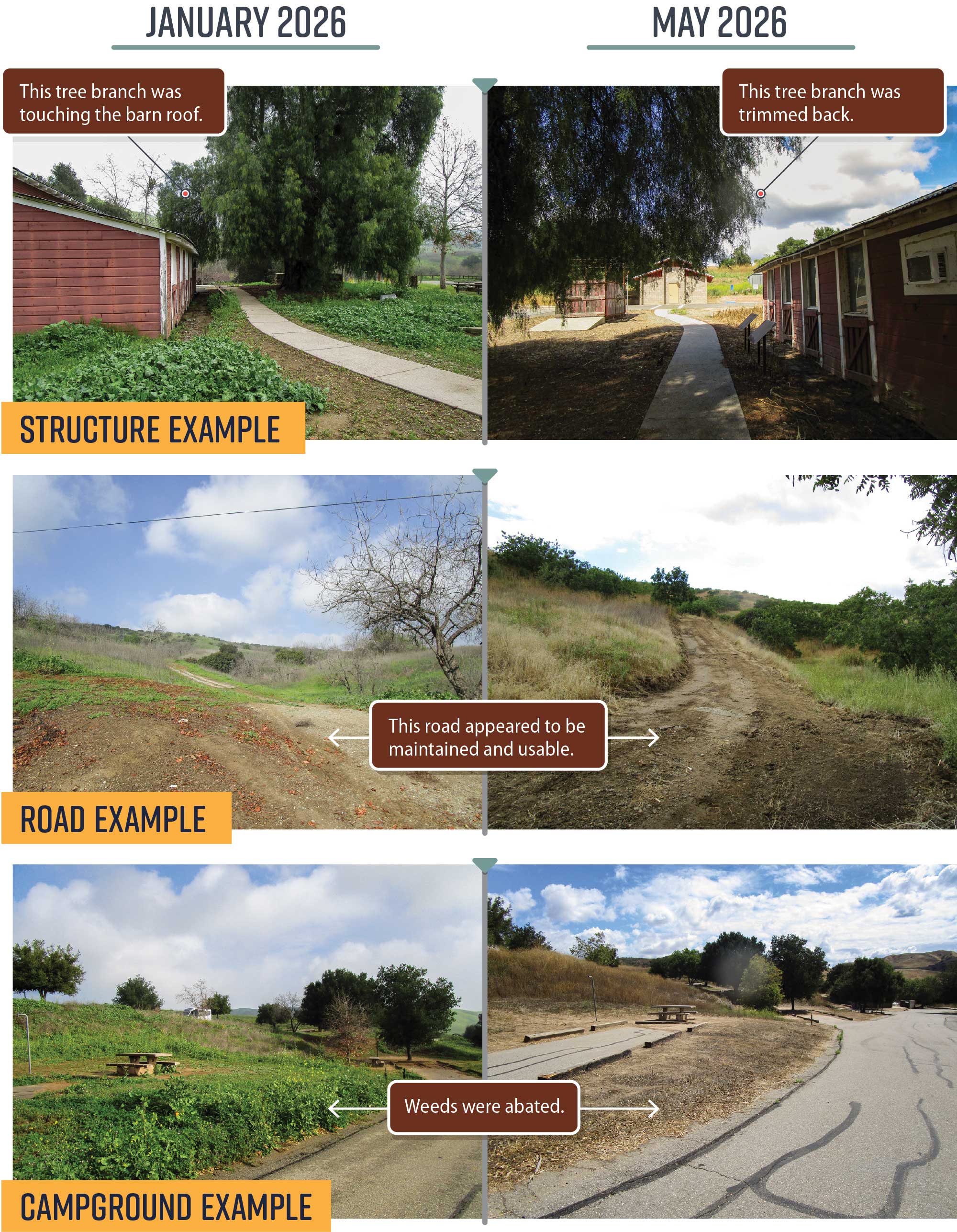
In May 2026, we observed that State Parks had completed wildfire resilience activities around structures, roads, and the campground, as we show in Figure 10. For example, Chino Hills State Park’s Wildfire Management Plan says that staff should remove all live plant parts in contact with ignitable portions of a structure in defensible space zones. In January 2026, our team noted a tree branch touching the roof of the park’s barn. However, in May 2026, our team saw that this tree branch had been trimmed back. Based on our observations, we concluded that State Parks acted to eliminate flammable materials around this structure to meet its internal standards at some point between January 2026 and May 2026. Appendix A contains additional photographs from our site visits.
Figure 10
We Observed That State Parks Completed Wildfire Resilience Activities in Chino Hills State Park to Meet Its Guidelines Around Structures, Roads, and the Campground Between January and May 2026
Source: Auditor observation.
Note: During our site visit in May 2026, our team viewed every habitable structure in the park that would require defensible space activities, every campsite, the only paved road, and most other roads that require vegetation maintenance for wildfire resilience. Our team determined that State Parks generally conducted wildfire resilience activities in accordance with the requirements in its Wildfire Management Plan between January 2026 and May 2026.
Figure 10 compares 6 photos from three different areas of the park. Three of the photos are under “January 2026” and adjacent to them are three photos under “May 2026.” The first pair of photos are an example of a structure in the park. The comparison of the photos shows that a tree branch was trimmed back and weeds were abated. These photos are accompanied by text boxes that point to the photos and say “this tree branch was touching the barn roof,” and “this tree branch was trimmed back.” The next two photos are an example of a road in the park. Both of the photos are accompanied by a text box that says “this road appeared to be maintained and usable.” The last pair of photos are an example of the campground in the park. Both of the photos are accompanied by a text box that says “weeds were abated.” This figure also contains a note that says “During our site visit in May 2026, our team viewed in the park every habitable structure that would require defensible space activities, every campsite, the only paved road, and most other roads that require vegetation maintenance for wildfire resilience. Our team determined that State Parks generally conducted wildfire resilience activities in accordance with the requirements in its Wildfire Management Plan between January 2026 and May 2026.” This figure shows that the team observed during a site visit that in 2026, State Parks generally completed its required wildfire resilience activities in the park.
State Parks noted that staff vacancies, which we discuss in more detail later, have significantly affected the outcomes and efficiency of its wildfire resilience activities in Chino Hills State Park. The Inland District superintendent stated that documenting wildfire resilience activities would help State Parks track the actions that staff perform and determine whether those actions meet the park’s guidelines.
To improve the wildfire resilience of Chino Hills State Park, State Parks also has implemented policies to reduce the risk of ignition. These policies include prohibiting smoking and campfires in the park, prohibiting equipment operations during high fire danger warnings or advisories, requiring fire spotter personnel for equipment operations, and requiring equipment to meet certain standards to reduce the risk of sparks.
Documentation Best Practices
Federal and state practices demonstrate the value of documentation. The National Parks Service reference manual states that all of a park’s vegetation management project information should be documented, maintained, and stored at the park or in a nationally approved repository. This information can encompass categories such as fuel treatment areas, WUI data, and facility risk assessments. For example, staff at the National Parks Service uploads WUI data about homes, water supplies, or cultural resources that could be threatened by wildfire into the National Park Service Fire Geodatabase on an annual basis. The National Park Service Fire Geodatabase is a repository for geographic information for all fuels projects.
California’s Wildfire and Forest Resilience Task Force (Wildfire Task Force) created the Wildfire and Landscape Resilience Interagency Tracking System (tracker) to obtain and communicate data on wildfire resilience activities in the State from multiple agencies. These data can include the activity name, description, funding source, organization implementing the activity, start and end date, and area treated. Although the tracker does display some wildfire resilience activities that State Parks completes in Chino Hills State Park, a State Parks Facility Ignition Prevention Program scientist explained that State Parks does not consistently report all its wildfire resilience activities to the tracker. She explained that this is because State Parks submits wildfire resilience activities to the tracker only for specific projects that receive specific grant funding to support this submission. According to the scientist, tracking all wildfire resilience activities in the tracker would not be feasible for various reasons, including a lack of district-level personnel with the knowledge to operate the tracker’s software and a lack of personnel to maintain and manage collected data.
Even if State Parks cannot feasibly enter all of its activities into the tracker, it could consistently document and report these activities publicly. This approach would provide assurance to the communities surrounding Chino Hills State Park that district staff are conducting the appropriate wildfire resilience activities.
Policies at Chino Hills State Park Could More Closely Align With State and Federal Best Practices
Chino Hills State Park’s Wildfire Management Plan is partly based on standards set in a department-wide wildfire management plan template (template). According to the Inland District senior environmental scientist, district staff began drafting the park’s Wildfire Management Plan in 2017, using a version of the template several decades old. Although State Parks updated the template in 2022 when it received a large influx of wildfire resilience funding, the final version of the park’s plan was not based on State Parks’ 2022 template. The Inland District’s senior environmental scientist stated that State Parks can modify the template to meet the current requirements of policies and laws, as well as the needs and conditions of each park. He further stated that the template is merely a guideline and that district staff adapt this template using professional judgment and knowledge of the landscape and the environment. Nevertheless, as we show in Table 2, Chino Hills State Park’s Wildfire Management Plan contains some aspects of the new template but does not incorporate all of the recommended sections that we identified would apply to the park.
We also reviewed standards located in a variety of federal fire management plans to determine whether Chino Hills State Park’s Wildfire Management Plan follows industry best practices. As we show in Table 3, the plan contains some aspects of selected best practices but does not incorporate all the best practices we identified. Appendix B presents a list of all the best practices that we identified, the components of the template, and whether those best practices and components were included in the park’s Wildfire Management Plan.
To boost wildfire resilience in the WUI, the National Park Service requires analyses and wildfire prevention plans for any of its parks that experience 26 or more human‑caused fires in a 10-year period. The National Park Service requires its parks’ wildfire prevention plans to also identify prevention actions and programs needed to reduce the likelihood of ignitions in areas where wildfire is unacceptable, who is responsible for each activity, and when each activity should be completed. However, State Parks has no similar policy. State Parks could consider such a requirement, which would include the determination of risks, hazards, and natural and human resources as they relate to wildfire prevention, as Table 3 defines. Although we identified only 11 wildfires that occurred in or around Chino Hills State Park in the past 10 years, the National Park Service manual for wildland fire management encourages parks that do not meet the minimum wildfire frequency to also complete a fire prevention analysis and plan, particularly if the park has experienced problems with human-caused wildfires.
The requirement to conduct such wildfire analyses and create wildfire prevention plans is relevant to the WUI because wildfire risks and hazards in these areas can endanger communities. As we mention in the Introduction, Chino Hills State Park ranks fourth in the State in area of land within two kilometers of its borders that the California Department of Forestry and Fire Protection (CAL FIRE) classifies as having housing adjacent to or interspersed in wildland. This type of land—the WUI—is where wildfire destroys most buildings within California. Given that State Parks’ current template recommends that wildfire management plans include a section on the WUI, State Parks should revise Chino Hills State Park’s Wildfire Management Plan to reflect relevant, current practices, including special consideration of the WUI. The section on the WUI should prompt district staff to consider the wildfire hazards that threaten non-department habitable buildings adjacent to State Parks property, as well as the vegetation types, fuel loading, and any wildfire mitigation that apply in border areas.
Chino Hills State Park’s Wildfire Management Plan also lacks a procedure for fuel assessment, or the process of determining the type, size, density, and continuity of fuels. CAL FIRE staff noted that fuel assessment is a procedure that staff conducts to monitor treatment effectiveness rather than evaluating wildfire hazard day-to-day. According to the unit forester for CAL FIRE’s San Bernardino-Inyo-Mono Unit, fuel assessment is primarily an academic or project-specific activity that might be conducted to determine which treatments are most effective for certain plants. The Inland District’s senior environmental scientist explained that district staff generally assess fuels by observing the landscape and vegetation during their performance of daily park activities. State Park’s chief of Natural Resources similarly stated that State Parks assesses fuel while considering other landscape conditions including ecosystem health, native species health, climate resilience, and biodiversity, among other things.
Nevertheless, Chino Hills State Park could benefit from an established procedure for identifying and documenting wildfire hazards, fuels, and topography on which fire will spread. State Parks policy leaves the decision on what sections to include in wildfire management plans to the discretion and professional expertise of district staff. However, State Parks should consider adding aspects of the 2022 department template and other best practices to Chino Hills State Park’s Wildfire Management Plan to ensure that staff accurately assess the fuels, hazards, and risks in the park.
We acknowledge that we cannot directly compare State Parks to the National Park Service. For example, the Santa Monica Mountains National Recreation Area—which is also near Los Angeles—has a dedicated branch for fire management, which includes a fire management officer, fire ecologists, fire geographic information system specialists, and engine crews. Although State Parks does not have these same wildfire resilience resources, the requirement to conduct wildfire prevention analyses and write wildfire prevention plans for locations with high numbers of human-caused ignitions reinforces the value of evaluating wildfire risk and hazards and providing clear actions in wildfire resilience planning. The Inland District superintendent and senior environmental scientist stated that there could be value in updating the plan to reflect relevant practices, including special consideration of the WUI, based on the department’s new template and federal best practices.
Staffing Problems Have Impeded State Parks’ Ability to Conduct Wildfire Resilience Activities at Chino Hills State Park
State Parks’ staffing challenges have hindered its ability to conduct wildfire resilience activities, possibly putting improvement efforts at risk. According to State Parks staff, the lack of a Chino Hills State Park manager, ongoing vacancies, and personnel time constraints have compromised the efficiency of State Parks’ wildfire resilience efforts in the park. The park was without a park manager from November 2023 to September 2024, and the individual who started in September 2024 left less than a year later in July 2025. The Inland District superintended noted that this position is difficult to fill because of the qualifications needed for the position. In March 2026, State Parks hired an acting park manager, who was still serving in that position as of July 2026.
State Parks’ Inland District’s maintenance team has also experienced workforce challenges, causing difficulty managing vegetation. As we previously describe, State Parks could not demonstrate that it consistently performed all wildfire resilience activities. The Inland District administrative chief explained that for fiscal year 2025–26 the district budgeted approximately $266,000 for permanent and seasonal maintenance costs at Chino Hills State Park. However, two of the park’s five maintenance positions were vacant at the time of this audit. Additionally, one maintenance worker had been on leave for a year, and another maintenance worker was planning to retire in 2026. The maintenance chief stated that the limited capacity of the park’s maintenance staff has significantly affected the outcomes and efficiency of wildfire resilience activities.
Although State Parks faces staffing challenges, the staff at the Inland District has yet to ask for additional funding or personnel. The Inland District superintendent noted that the largest challenge to filling positions is the budget and that the district has not submitted a budget change proposal for more positions at Chino Hills State Park since 2013. According to the Inland District maintenance chief, State Parks would need to obtain nine more permanent maintenance staff to better manage vegetation around Chino Hills State Park’s roads and trails. By combining the average salaries for these maintenance staff positions, the maintenance chief estimated that these positions would cost about $500,000 per year total. The maintenance chief shared that managing the park’s roads and trails involves activities such as trimming back vegetation and grading the park’s roads. However, these activities can be difficult to complete due to conservation rules for sensitive species, the clay soil type in the park, and the length of roads and trails in the park. If the Inland District obtained nine more permanent maintenance staff, these staff members would be able to dedicate more time to work on road and maintenance activities.
Nevertheless, the Inland District superintendent explained that to justify additional positions, Chino Hills State Park would have to experience an extreme change in operation. She added that the district’s budget generally does not cover the costs for all current permanent positions—which is consistent across State Parks’ districts. Consequently, the superintendent stated that she must use vacancy savings to cover other costs. State Parks’ Natural Resources chief added that the Inland District has limited financial and staff resources dedicated to coordination with fire suppression agencies and neighboring local governments and that the district staff are responsible for seven additional parks, spanning more than 30,000 acres of additional land.
Nonetheless, State Parks has not demonstrated that it can complete all wildfire resilience activities outlined in Chino Hills State Park’s Wildfire Management Plan while facing staffing challenges. Because State Parks staff cited a lack of personnel as a key obstacle to completing wildfire resilience activities, the Inland District should analyze its maintenance workforce and submit a budget change proposal to the Legislature for additional positions to ensure staff at Chino Hills State Park is able to meet the park’s wildfire resilience needs.
State Parks Could Increase Collaboration With Neighboring Landowners, Local Entities, and CAL FIRE
Key Points
- Although guidance from California’s Wildfire Plan recommends that State Parks expand collaboration with local landowners and agencies, State Parks’ policies and procedures provide limited opportunities for it to do so. As a result, State Parks has not expanded collaboration with landowners or local governments near Chino Hills State Park.
- The Boundary Vegetation Modification Right of Entry permit (vegetation permit) process at Chino Hills State Park allows a neighboring party to remove vegetation on State Parks’ land to create a defensible space for habitable structures. However, the park has only ever received one vegetation permit application. Revisions to the California Wildfire Mitigation Program (mitigation program) could help the park’s neighbors to better protect their homes from fires.
- Staff at Chino Hills State Park have not coordinated annual meetings with local suppression agencies, as required by the park’s Wildfire Management Plan. At these meetings, Inland District staff could provide information on fire control features and other pertinent park information. By forgoing these meetings, State Parks puts efforts to improve wildfire resilience at risk.
- State Parks has not met with CAL FIRE to discuss and update Chino Hills State Park’s Wildfire Management Plan as required annually by its Interagency Agreement (IAA) with CAL FIRE. Consequently, State Parks has forgone opportunities to improve the park’s Wildfire Management Plan and familiarize fire personnel with the plan.
Revisions to the Mitigation Program Could Help Property Owners Around Chino Hills State Park Better Protect Their Homes
As we describe in the Introduction, the Wildfire Task Force published California’s Wildfire Plan, which set broad goals to further its focus on addressing the increasing danger of wildfire. The plan states that State Parks should, in partnership with the California Natural Resources Agency and other state landowning agencies, execute a strategy that includes expanding collaboration with neighboring landowners and agencies to promote resilient and healthy forests across ecosystems and human systems in California. By expanding collaboration with these neighboring landowners and agencies, as well as implementing other parts of the strategy to restore and protect California’s natural areas, State Parks and other state landowning agencies could deliver on the plan’s goals related to forest health, fire prevention, climate resilience, carbon neutrality, biodiversity, and outdoor access for all.
Despite this guidance, we found that the wildfire resilience policies at Chino Hills State Park provide limited opportunities to expand collaboration with neighboring landowners. The main tool State Parks has established for collaborating with neighboring individual landowners around the park are vegetation permits. Vegetation permits give parties who share common boundaries with a state park permission to access State Parks’ land to conduct defensible space vegetation removal. An approved vegetation permit allows the party applying for the permit to access State Parks’ land and trim vegetation within 130 feet of the party’s closest habitable structure. For example, a neighboring landowner whose home is within 130 feet of State Parks’ land could apply for a vegetation permit to clear a defensible space for their home.
State Parks confirmed that Chino Hills State Park has received only one vegetation permit application since the park was established. However, the Inland District environmental coordinator stated that the applicant decided not to pursue the vegetation permit for various reasons, including that the applicant would need to coordinate with other entities that owned land in the area it requested to modify. The environmental coordinator also noted that most parties who ask about vegetation permits believe that State Parks will clear the vegetation. After the landowners learn that they need to perform the work, they are not interested in pursuing the permit. State Parks also shared that some districts make significant efforts to inform the public of vegetation permits. For example, State Parks staff stated that last year the Angeles District sent mailers to 756 residences and participated in community meetings. Its effort resulted in that district successfully executing five vegetation permits.
According to the Inland District superintendent, the district primarily performs community outreach for its vegetation permit program by posting about the program on its website. The superintendent stated that the district also attends community events to provide educational outreach about Chino Hills State Park. The district has discussed vegetation permits with local residents during these events but does not specifically attend these events for vegetation permit community outreach. In addition, the Inland District superintendent asserted that the district had not sent out informational mailers regarding vegetation permits because the district has not identified this as an appropriate method to notify all neighbors with habitable structures within 130 feet of the park. The Inland District superintendent shared that the district believes that in general, neighboring parties do not apply for vegetation permits because they do not want to perform the vegetation management themselves, not because they are unaware of the program. The district superintendent clarified that the district believes that neighboring parties generally are aware of the vegetation permit program and contact the district when they want to learn more about vegetation permits.
The State has a program that the Legislature could expand to make vegetation permits more attractive to landowners around Chino Hills State Park. According to State Parks, landowners are responsible for the labor and cost of vegetation removal, which could be a barrier to pursuing the vegetation permit. However, state law has established the mitigation program to reduce fire risk by providing financial assistance for building retrofits, hardening structures, maintaining defensible space, managing vegetation, and performing fuel modification in eligible wildfire hazard areas. The mitigation program is administered by the California Wildfire Mitigation Program Authority (CWMPA) under a joint powers agreement between the California Governor’s Office of Emergency Services and CAL FIRE. The CWMPA was responsible for developing criteria and a scoring methodology, consistent with established standards, to prioritize distributing financial assistance through the mitigation program to specific areas and communities. State law requires selecting areas for the mitigation program based partly on factors that may inhibit the ability to respond to a wildfire, including socioeconomic characteristics of the area such as poverty levels, number of residents with disabilities, and number of households without a car.
Although Chino Hills State Park is mostly located in a very high severity zone, the park was not in any of the counties selected for the mitigation program as of April 2026. If the communities surrounding Chino Hills State Park were included in the mitigation program, the park’s neighbors who sought and received vegetation permits could receive financial assistance to help protect their property from fires. The process of performing this work could also increase communication between the landowners and State Parks. CWMPA staff agreed that if state law was amended, it would be feasible to include the park in the mitigation program; however, they suggested that a similar program administered outside the CWMPA would be better, as the current mitigation program largely uses federal funding with specific requirements to accept the funds.
The CWMPA published a report on the mitigation program in March 2026. This report said that as of March 2026, the program had spent $1.2 million on defensible space activities at its 108 sites with costs reported. This works out to about $10,000 spent on defensible space activities per site with costs reported. According to a State Parks geospatial manager, about 170 habitable structures stand within 130 feet of Chino Hills State Park’s land. Expanding the mitigation program to cover defensible space activities for these structures at approximately $10,000 per site could cost the State about $1.7 million. If eligible, individual landowners could use the money provided by the mitigation program to clear defensible spaces around their homes after coordinating with State Parks to receive an approved vegetation permit. As a result, the mitigation program could help to protect the surrounding communities from wildfire.
State Parks Should Expand Collaboration With Local Agencies Near Chino Hills State Park to Align With California’s Wildfire Plan
As we describe above, California’s Wildfire Plan states that State Parks should execute a strategy that includes expanding collaboration with neighboring landowners and agencies. However, we found that similar to its policies related to neighboring landowners, the wildfire resilience policies at Chino Hills State Park provide limited opportunities to expand collaboration with neighboring agencies. There are two mechanisms that State Parks’ manual and Chino Hills State Park’s Wildfire Management Plan provide for facilitating collaboration with neighboring agencies. First, the guidance recommends that Inland District staff coordinate an annual meeting with suppression agencies in which district staff can provide pertinent fire‑related information regarding the park. Second, it prescribes State Parks Inland District staff to coordinate planning meetings with suppression agencies to review and update the park’s Wildfire Management Plan. In this report, we refer to both of these meetings as suppression meetings.
Additionally, an IAA between State Parks and CAL FIRE requires an annual interagency meeting between the local CAL FIRE unit and State Parks district staff to discuss, update, and approve any changes in each park’s Wildfire Management Plan. We will discuss this IAA requirement for the CAL FIRE meeting further in the next section. Table 4 describes the elements of each meeting that State Parks should participate in or hold, according to its plan or other statewide guidance.
Contrary to Chino Hills State Park’s Wildfire Management Plan requirements, State Parks district staff have not met with local fire suppression agencies for suppression meetings at which State Parks district staff could provide the agencies with pertinent park information, which the text box lists. We reviewed documentation from Inland District staff’s meetings with local fire suppression agencies from January 2023 to December 2025, including email correspondence, and found that the district staff have not held these suppression meetings.
Examples of Information That State Parks Could Share During Annual Meetings With Suppression Agencies
- Biotic features, such as chaparral and grasslands.
- Abiotic features, such as climate and soil.
- Facility features, such as structures and campsites.
- Fire control features, such as fuel breaks and defensible spaces.
Source: Chino Hills State Park’s Wildfire Management Plan and State Parks documentation.
Inland District staff have attended various meetings with other agencies in the last three years, but they could not demonstrate that these meetings constituted the required suppression meetings with local suppression agencies. The meeting documentation the Inland District staff provided does not contain the discussion items listed in Chino Hills State Park’s Wildfire Management Plan. For example, we found some evidence that Inland District staff attended multiple U.S. Geological Survey Southern California Resource Advisor meetings; however, we did not ascertain that the park or its fire control features were discussed or reviewed at these meetings. Additionally, none of the documentation for meetings we reviewed demonstrated discussion of the park’s Wildfire Management Plan.
The Inland District superintendent explained that State Parks district staff have not yet coordinated suppression meetings with fire suppression agencies because of staff vacancies, including the park manager position—an issue we previously discuss. Nonetheless, holding such meetings would provide Inland District staff with the opportunity to familiarize local fire personnel with Chino Hills State Park, its fire control features, and its Wildfire Management Plan. This could improve fire suppression efforts in the event of a fire emergency inside the park. The Inland District superintendent agreed that the meetings can familiarize new staff with the park and added that the suppression meetings can strengthen relationships with other agencies. By forgoing meetings with suppression agencies, Inland District staff did not take advantage of opportunities to improve fire suppression efforts and to familiarize new staff with the park.
National standards reiterate the value of working and meeting with local agencies to plan for wildfires. The 2025 Interagency Standards for Fire and Fire Aviation Operations (Interagency Standards) provide program direction for federal fire management plans and note that fire management plans should be developed collaboratively between federal, tribal, local, and state agencies to accomplish resource and protection objectives. The Interagency Standards also state that when practical, fire management plans should contain mutually developed objectives for managing fires that cross jurisdictional boundaries. Although State Parks does not have the same wildfire resilience resources as federal agencies such as the National Park Service, these Interagency Standards highlight the importance of working with other agencies to develop plans for wildfire management collaboratively.
The fire management plan for the National Park Service’s Santa Monica Mountains National Recreation Area (Santa Monica Mountains) provides an example of how interagency collaboration could be included in Chino Hills State Park’s Wildfire Management Plan. Santa Monica Mountains’ fire management plan directs its staff to attend interagency planning meetings before each fire season. These meetings are intended to enhance cooperation and coordination to maximize efficiency in managing wildland fire incidents. For example, the plan includes an outline of the Santa Monica Mountains fire management program activities. These activities include a meeting with cooperating entities to review and revise interagency agreements and a meeting with other fire management organizations to coordinate before the fire season.
State best practices can also serve as a guide for how landowning state agencies can collaborate with neighboring landowners in wildfire resilience planning. For example, the Science Advisory Panel to the Wildfire Task Force emphasized the importance of regional collaboration, including a need for new partnerships with organizations that have not traditionally been involved in fire resilience planning, such as city planning departments and municipal governments. The panel noted that increasing wildfire resilience, especially in California, requires a more holistic approach that encompasses nontraditional organizations because wildfire is connected to other challenges that Southern California is experiencing related to housing, transportation, drought, and climate change. Panel Members explained that consideration of these connections can help inform smarter regional planning. Requiring the Inland District to meet with local government staff on an annual basis would be a first step in creating these partnerships, especially when wildfire resilience also touches upon other economic and climate issues beyond strict wildfire management policies.
State Parks generally attributes not expanding collaboration with landowners and agencies to the jurisdictional complexity surrounding Chino Hills State Park and to resource constraints. According to State Parks’ chief of Natural Resources, the abundance of neighboring entities with interest in the park creates a unique set of challenges in attaining State Parks’ goal of sustaining ongoing collaboration with those entities. Additionally, the Inland District superintendent stated that the district does not collaborate with neighboring landowners on vegetation management because of the number of private property owners surrounding the park and the difficulty of collaborating with individual landowners instead of organizations like homeowner’s associations.
Nonetheless, all the local governments and fire suppression agencies we spoke to expressed a desire for increased communication from State Parks. We describe the local governments and fire suppression agencies with which we met later in the report. Although the presence of many landowners certainly complicates collaborative efforts, annual meetings between State Parks and city staff would provide a space for participants to navigate their different planning priorities and timelines, and to clarify jurisdictional responsibility, fostering greater policy alignment and transparency in wildfire resilience planning.
State Parks and CAL FIRE Are Not Meeting Annually, Contrary to Their Statewide Interagency Agreement
State Parks Inland District staff have not held or attended an interagency wildfire planning meeting to discuss Chino Hills State Park’s Wildfire Management Plan, contrary to the requirements in State Parks’ IAA with CAL FIRE, putting opportunities to improve the Wildfire Management Plan and to familiarize fire personnel with the plan at risk. The IAA between State Parks and CAL FIRE states that the two entities will hold annual meetings at district and park levels before fire season. The agreement states that State Parks district staff and CAL FIRE staff will meet to discuss, update, and approve any changes in each park’s wildfire management plan.
We reviewed documentation from the Inland District staff’s meetings and found that they have not held or attended the prescribed interagency wildfire planning meeting with CAL FIRE. None of the Inland District staff’s other meetings discussed Chino Hills State Park’s Wildfire Management Plan, which serves as the key component in the IAA’s requirement for an annual meeting. For example, email documentation shows that Inland District staff met with Chino Valley Fire District to discuss a training drill and the park’s conditions. However, the meeting did not include CAL FIRE nor a review of the park’s Wildfire Management Plan.
The Inland District superintendent confirmed that staff have yet to hold this meeting and explained that a large hurdle was the lack of a park manager to coordinate the meeting. As we noted earlier, the park manager position was largely vacant from 2023 until March of 2026. In addition, the Inland District superintendent noted that CAL FIRE has high turnover, making it difficult to identify who should be invited. Nonetheless, the IAA does not specify who at State Parks must coordinate the meeting, nor whether CAL FIRE or State Parks district staff have the responsibility for coordination.
A CAL FIRE San Bernardino unit forester stated that his staff communicates with State Parks regularly and that, because of CAL FIRE’s wildland fire suppression responsibility, it would be reasonable to have occasional meetings to discuss Chino Hills State Park’s Wildfire Management Plan, although he questioned whether it would need to be on an annual basis. In addition, a senior environmental scientist of Wildfire and Forest Resilience stated that he interprets the IAA meeting requirement as guidance rather than as a requirement and that district staff have many commitments to fulfill. Regardless of this perspective, a Wildfire Season Preparedness Checklist from State Parks’ headquarters includes this meeting as a step in wildfire season preparedness. Additionally, the Inland District superintendent stated that the district would value this meeting as an opportunity to build personal relationships with fire agency personnel and to familiarize personnel with Chino Hills State Park’s goals. By not holding the prescribed interagency meeting with CAL FIRE, State Parks has forgone opportunities to identify changes in the park’s Wildfire Management Plan, to refamiliarize fire personnel with the plan, and to strengthen relationships with fire suppression personnel.
SCE Performs Wildfire Resilience Activities on Its Power Lines and Often Coordinates With State Parks
Key Points
- In compliance with state law, Southern California Edison (SCE) performs several activities, such as vegetation management and regular inspections, to mitigate the risk of utility-caused wildfire. The Office of Energy Infrastructure Safety (Energy Safety), the agency responsible for oversight of SCE’s wildfire resilience activities, has found SCE to have completed 90 percent of its planned wildfire resilience activities for the most recent compliance year evaluated.
- Although SCE has access to its power lines in Chino Hills State Park to perform wildfire resilience activities, some projects—like using drones to inspect power lines—require approval from State Parks.
SCE, Overseen by Energy Safety, Bears Responsibility for Minimizing Wildfire Risk Around Power Lines in Chino Hills State Park
SCE owns and maintains overhead power lines in Chino Hills State Park. Four overhead transmission lines cross the park and several overhead distribution lines are around its perimeter, as Figure 11 shows. Transmission and distribution lines deliver generated electricity to consumers, as Figure 12 depicts.
Figure 11
SCE Owns Multiple Distribution and Transmission Lines That Cross Into Chino Hills State Park
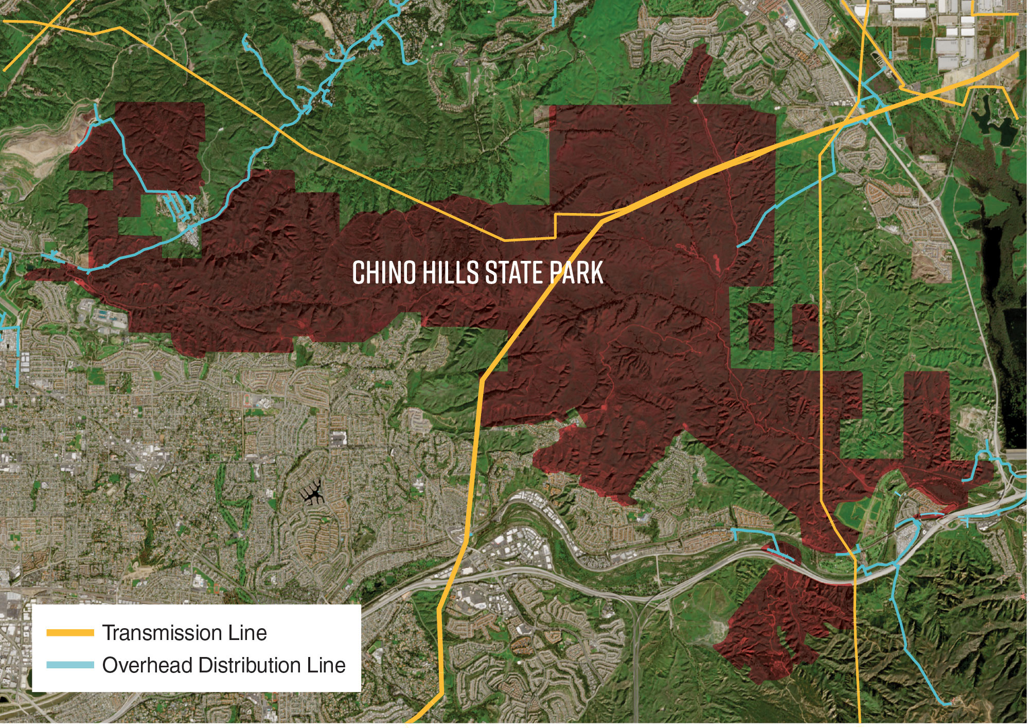
Source: Auditor-generated using SCE, State Parks, and Copernicus Sentinel [2026] data.
Figure 11 shows map of SCE’s transmission lines, overhead distribution lines, and underground distribution lines in the park. This figure shows that there are limited transmission and distribution lines in the park, including one large transmission line that splits in the center of the park.
Figure 12
Transmission and Distribution Lines Deliver Generated Electricity to Consumers
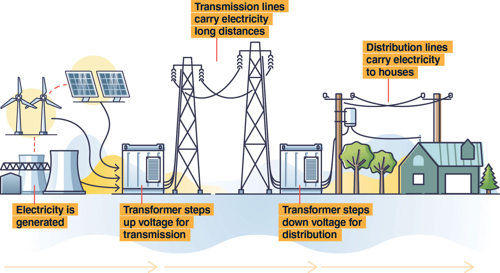
Source: U.S. Energy Information Administration.
Figure 12 shows the chronological steps that generated electricity goes through to be delivered to consumers. The graphic depicts wind turbines, solar panels, reactors, and cooling towers with the caption, “energy is generated.” Next, the graphic depicts a transformer with the caption “transformer steps up voltage for transmission.” Pictured after are transmission lines, with the caption, “transmission lines carry electricity long distances”. A second transformer is pictured and is captioned, “transformer steps down voltage for distribution.” Lastly, the graphic depicts smaller transmission lines and a house with the caption, “distribution lines carry electricity to houses.” This figure shows that transmission lines carry electricity with greater voltage, and distribution lines carry electricity with less voltage.
State law requires electrical corporations, such as SCE, to construct, maintain, and operate their electrical lines and equipment in a manner that will minimize the risk of catastrophic wildfire. To fulfill this responsibility, electrical corporations are required to prepare a wildfire mitigation plan that describes their preventive strategies and programs to minimize these risks. In the case of SCE, these wildfire resilience activities include, but are not limited to, vegetation management, asset inspections, system hardening, and Public Safety Power Shutoffs. Table 5 describes some of these activities.
SCE’s wildfire resilience activities are informed by its risk framework which prioritizes mitigation activities according to wildfire risk. SCE has defined its own High Fire Risk Area, or areas it has deemed to be at a high risk from wildfire. SCE told us that as of June 2026, the entire park resides in SCE’s High Fire Risk Area. According to SCE, it prioritizes wildfire mitigation activities in the areas identified by its risk models as having the highest potential wildfire risk, and this risk assessment is key in determining the location, scale, scope, and frequency of mitigation activities.
One wildfire resilience activity that SCE performs in the park is vegetation management. In SRAs, CAL FIRE regulations require vegetation clearance around distribution poles carrying specific equipment, which SCE accomplishes through its Structure Brushing Program. SCE’s goal is to implement this program throughout its High Fire Risk Area, regardless of whether a pole is in an SRA. SCE attests that as of March 2026, all applicable structures located in Chino Hills State Park are inspected and if necessary, cleared of vegetation. Figure 13 shows these pole clearance requirements. On a visit to the park in May 2026, we observed that vegetation clearance from power lines generally followed state law.4 Figure 14 shows an example of a distribution pole we observed and concluded met state line clearance requirements.
Figure 13
SCE Attempts to Clear Vegetation Regardless of Whether State Requirements Apply
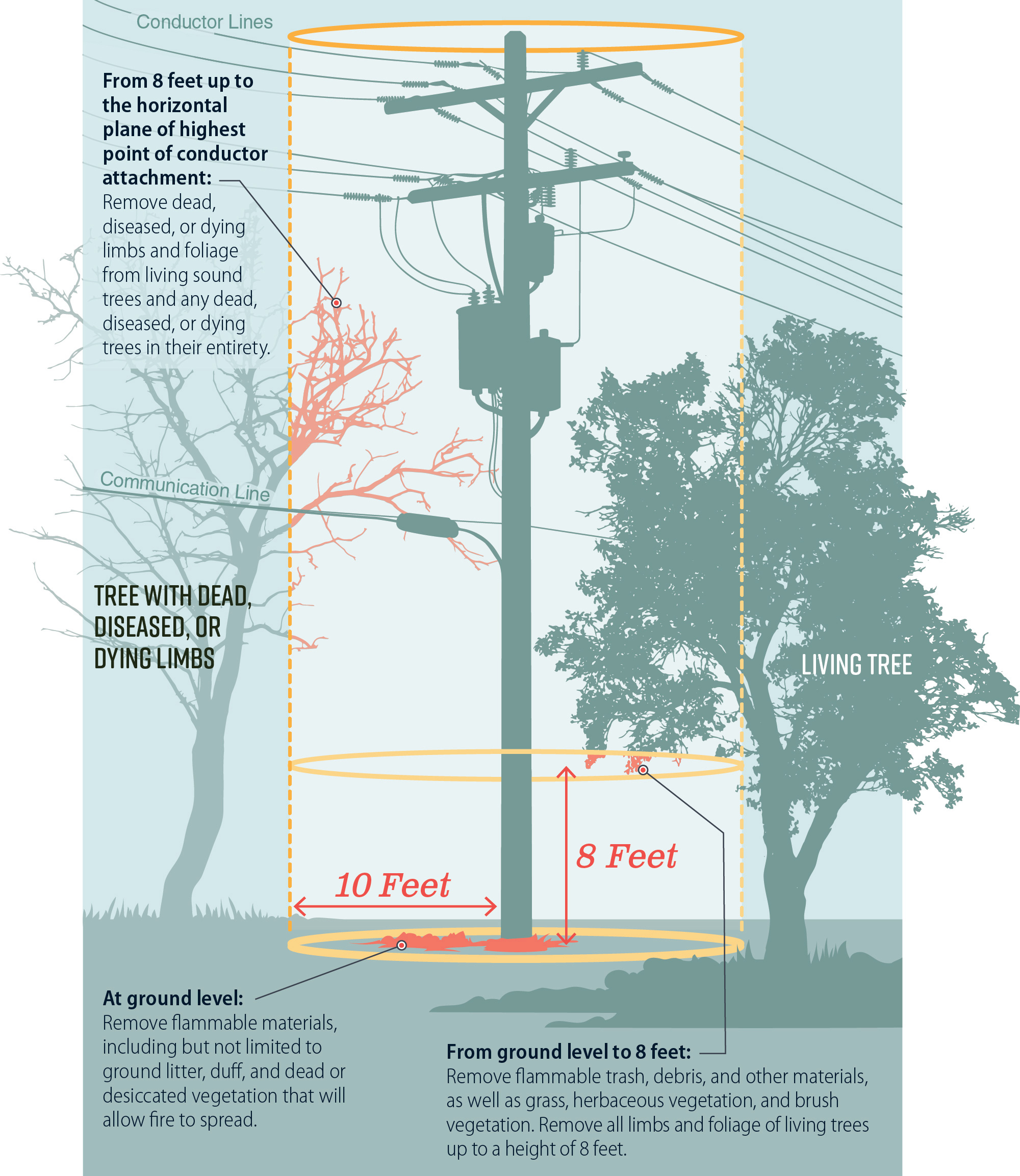
Source: State law and SCE policy.
Note: SCE stated that there are six SCE assets in Chino Hills State Park for which clearance requirements for poles would apply but that as of March 2026, it has inspected and cleared, if necessary, all the structures within the park.
Figure 13 shows a graphic demonstrating the different vegetation clearance standards, such as clearing grass and trees, SCE attempts for poles in the park. A pole in the center of the graphic has conductor lines running through its top, a nearby tree with dead, diseased, or dying limbs, a nearby living tree, and nearby grass. One text box points to the ground, up to 10 ft around the base of the pole, and says, “at ground level: Remove flammable materials including but not limited to, ground litter, duff and dead or desiccated vegetation that will allow fire to spread.” Another text box points to the area eight feet above the ground and says, “from ground level to 8 feet: Remove flammable trash, debris, or other materials, as well as grass, herbaceous vegetation, and brush vegetation. Remove all limbs and foliage of living trees up to a height of eight feet.” The last text box points to a dead tree limb near the pole and says, “from 8 feet to horizontal plane of highest point of conductor attachment: Remove dead, diseased, or dying limbs and foliage from living sound trees and any dead, diseased, or dying trees in their entirety.” Below this figure, there is a note that says, “SCE attests that there are no SCE assets in Chino Hills State Park for which clearance requirements for poles would apply but that as of March 2026, it has inspected and cleared, if necessary, all structures within the park.”
Figure 14
Example of a Distribution Pole We Observed to Meet Minimum Tree Trimming Requirements
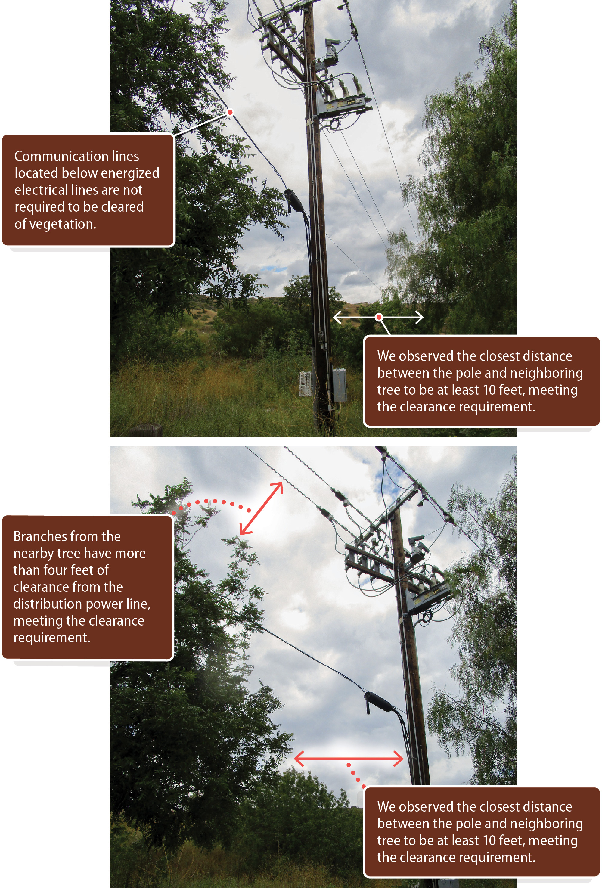
Source: State law, CPUC, and auditor observation.
Notes: Because of the perspective of the photograph, objects in the image may appear closer than they were observed. Auditors observed a minimum distance of 10 feet between tree branches and the utility pole, up to eight feet off the ground, and a minimum distance of four feet between tree branches and electrical lines.
Ground vegetation around the pole was not cleared at the time the image was taken, though SCE later confirmed that, if inspected in this state, the pole would be remediated to comply with pole clearance requirements. This structure was last cleared in June 2025 and is scheduled to be cleared in 2026.
Figure 14 shows two annotated photos of a pole in the park from our team’s site visit. This figure generally demonstrates that the clearance around this pole met minimum vegetation clearance requirements. The images contain four total text boxes. The first text box points to a lower line that overlaps with some vegetation and says, “Communication lines located below energized electrical lines are not required to be cleared of vegetation.” The next text box points to the distance between the pole and a nearby tree. It says, “We observed the closest distance between the pole and neighboring tree to be at least 10 feet, meeting the clearance requirement.” The third text box points between a nearby tree and distribution lines. It says, “branches from the nearby tree have more than four feet of clearance from the distribution power line, meeting the clearance requirement.” The last text box points to the distance between the pole and another nearby tree. It says, “We observed the closest distance between the pole and neighboring tree to be at least 10 feet, meeting the clearance requirement.” This figure contains a note that says, “Because of the perspective of the photograph, objects in the image may appear closer than they were observed. Auditors observed a minimum distance of 10 feet between tree branches and the utility pole, up to eight feet off the ground, and a minimum distance of four feet between tree branches and electrical lines. Ground vegetation around the pole was not cleared at the time the image was taken, though SCE confirmed that, if inspected in this state, the pole would be remediated to comply with pole clearance requirements. This structure was last cleared in June 2025 and is scheduled to be cleared in 2026.”
SCE’s goal is to perform annual vegetation clearance inspections for all its distribution and transmission lines. SCE also conducts more frequent and ignition‑focused risk inspections of equipment in its High Fire Risk Area. The purpose of these inspections is to identify equipment or structure degradation that could lead to a potential ignition risk. Inspections can occur on the ground and through aerial technology like drones. We reviewed documentation of both vegetation and asset inspections that SCE conducted in Chino Hills State Park that demonstrate inspections occurred.
Another wildfire resilience activity that SCE performs in Chino Hills State Park is Public Safety Power Shutoffs. Public Safety Power Shutoffs are the proactive de‑energization of power lines to reduce risk of wildfire under dangerously high winds, low humidity, and dry vegetation conditions. According to SCE data, there were 16 Public Safety Power Shutoff events within the park’s boundaries from 2021 to 2025. Nine of these events occurred in January 2025, around the time of the Palisades and Eaton Fires.
Energy Safety is the department responsible for ensuring that electrical corporations such as SCE are reducing their wildfire risk and adhering to their approved wildfire mitigation plans. To ensure electrical corporations are sufficiently reducing their wildfire risk, Energy Safety performs several oversight activities, including reviewing and approving wildfire mitigation plans, conducting vegetation management audits, and performing field inspections.
In its most recent report on SCE, Energy Safety acknowledged that SCE undertook efforts to reduce its wildfire risk. In its annual reports on compliance for SCE, Energy Safety reviews its own audits and field inspections; the findings of SCE’s independent evaluator; SCE’s self-assessment and data submitted by SCE to Energy Safety.5 Energy Safety conducted one field inspection of SCE assets at or within the boundary of the park and found no violations. Energy Safety’s most recent annual report on compliance for SCE, published in 2025, found that SCE met 90 percent of its 2023 Wildfire Mitigation Plan initiative targets for that year and that no systemic issues hindered SCE’s ability to adequately implement its plan in 2023. In its most recent Vegetation Management Audit of SCE for the 2023 compliance year, Energy Safety determined that SCE’s vegetation management program complied with 11 of its 13 vegetation management initiatives. In that audit, Energy Safety identified recordkeeping and documentation issues within several of SCE’s vegetation management programs that required corrective actions, but ultimately found that SCE substantially complied with its Wildfire Mitigation Plan requirements.
State Parks Coordinates With SCE for Some Wildfire Resilience Projects
State Parks and SCE coordinate to facilitate SCE’s wildfire resilience activities in the park. According to Inland District staff, SCE notifies State Parks when it plans to complete work that is more than a visual inspection of its power lines or access roads. State Parks confirmed that there is no single statewide policy specifying which utility activities require notification versus formal approval, though the distinction is generally defined by whether the work is completed within or outside a utility’s easement, respectively.
SCE has some rights to access its assets without the need to seek approval or notify State Parks. SCE’s easement for its distribution and transmission lines provides it with access to its assets for the purpose of routine inspections and maintenance, though it does not define these activities. State law also allows the owner of an electrical distribution or transmission line to traverse land as necessary regardless of land ownership for the purpose of pruning vegetation to maintain required line clearances so long as it notifies landowners and provides them with an opportunity to be heard. Despite this access, State Parks requires prior approval for drone inspections, as drones are otherwise prohibited in the park. District staff explained that drone inspection requests are the most common approval request they receive. SCE has requested approval for drone inspections of its equipment three times since October 2024.
SCE has also collaborated with State Parks to work outside SCE’s easement. In the last two years, SCE and State Parks have coordinated on 13 different work projects ranging from drone inspections of equipment or structure clearing activities to larger projects, such as the undergrounding of a distribution line in the park that was completed in 2024. These projects have been the result of successful coordination between State Parks and SCE, although district staff told us that utility companies sometimes have unreasonable expectations for the expediency of the approval process. District staff told us that the district has an internal goal of approving utilities’ drone requests within two weeks. However, two of the three drone inspection requests from SCE that we reviewed took over a month to approve. District staff explained that the district is small and therefore often must use outside resources to fulfill approval requests, which can lengthen the approval timeline.
We also reviewed evidence of State Parks staff monitoring SCE crews in the park. On one occasion, district staff reached out to SCE to say that park staff noticed SCE crews smoking in the park, which is prohibited. On another occasion, park staff mistakenly turned SCE crews away because they misunderstood whether there was prior approval for certain equipment SCE brought to use in the park. In this instance, district staff clarified to employees in an email that they had approved SCE’s work and emphasized the benefit of the work SCE performed. Additionally, State Parks district staff met with SCE in May 2024 to discuss fire contingency requirements for their work in the park, including weather-dependent work restrictions and the prohibition of spark-throwing equipment under certain conditions. These examples demonstrate that there is some evidence that park staff monitors SCE crews in the park even after their work is approved by district staff.
Other Areas We Reviewed
To address the audit objectives approved by the Joint Legislative Audit Committee, we identified which wildfire resilience activities are taking place in areas surrounding Chino Hills State Park. In addition, we reviewed other guidelines in California’s Wildfire Resilience Plan to determine whether these activities are appropriate for the park and its ecosystem. Finally, we also reviewed state law and State Parks policy to assess the applicability of local ordinances on State Parks’ land.
Local Entities Provide Public Education and Inspect Areas Surrounding Chino Hills State Park for Vegetation Management Purposes
Audit Objective 4 directed us to identify the fuel management and abatement activities that have occurred in the area surrounding Chino Hills State Park and determine which entities have conducted those activities. Local entities complete wildfire resilience activities outside the park, including maintaining vegetation management programs. We spoke to five local governments and fire departments (agencies) in areas surrounding the park, which the text box lists. We found that each agency conducts some wildfire resilience activities, as we show in Table 6.
Local Agencies in Areas Surrounding the Park to Which We Spoke:
Wildfire resilience activities can include the following:
- City of Chino Hills
- Chino Valley Fire District
- City of Yorba Linda
- Orange County Fire Authority
- City of Brea/Brea Fire Department*
Source: Auditor research.
* Brea Fire Department is a branch of the city of Brea.
We found that each agency follows a defensible space or weed abatement program. By following these programs, the agencies can identify whether hazardous fuel or vegetation is cleared from structures by inspecting private landowners’ property. Additionally, all the agencies have held or attended public events to educate constituents on wildfire preparedness. For example, the city of Brea/Brea Fire Department’s (Brea) public awareness event included information on how fire spreads in the WUI and how to make a home more ember-resistant. We also found that each of the three suppression agencies we spoke to provide the public with resources online on how to bolster wildfire resilience. These online resources include providing information on home hardening—the practice of managing vegetation and building structures to resist fire—and defensible space requirements. Finally, we also found that both Orange County Fire Authority and Brea use ALERT California cameras to watch for fire activity in the areas surrounding the park.6
State Parks explained that it is not involved in any wildfire resilience activities outside Chino Hills State Park, and state law does not require State Parks and local agencies to collaborate on these activities. The Inland District superintendent shared that this is because most of the land outside the park’s boundaries is privately owned.
Guidance From the Wildfire Task Force Suggests That Scaling Up Prescribed Fire and Fuel Reduction Programs Is Not Appropriate for Chino Hills State Park
Audit Objective 3 asked us to determine Chino Hills State Park’s wildfire mitigation and fuel management policies and practices, to identify what standards they are based on, and to assess whether they align with key state wildfire prevention policies and plans, including California’s Wildfire Plan. Although California’s Wildfire Plan asks State Parks to scale up prescribed fire and fuel reduction programs in the State, scientific evidence suggests that wildfire guidance does not universally apply to all park ecosystems and that following this action would negatively impact the health and wildfire resilience of Chino Hills State Park.7 Along with the instruction to expand collaboration with neighboring landowners and agencies, which we discuss previously, California’s Wildfire Plan recommends that State Parks partner with California Natural Resources and other state landowning agencies to scale up prescribed fire and fuel reduction programs.
However, guidance provided by the Science Advisory Panel of the Task Force (Advisory Panel) explains that many areas of Southern California are experiencing fires at a rate of once every 20 years or less when most chaparral and shrubland ecosystems experienced fire only every 30 to 130 years before Euro-American settlement in these areas. The occurrence of fire above its natural frequency, along with other factors like drought, have caused the vegetation to change from native shrub species like chaparral and coastal sage scrub to non-native annual grasses, which now make up 70 percent of the park. The Advisory Panel explained that, because grasses can be more flammable than woody fuels like chaparral, this conversion can lead to a feedback cycle of increasing fire ignitions and decreasing native shrub species, which diminishes wildfire resilience. In 2025, State Parks reported to the tracker that Inland District Staff had provided about 100 treatments to control non-native species using herbicides or other means.
The Advisory Panel also explained that management actions that have been recommended for returning forest ecosystems to historic conditions and increasing wildfire resilience are detrimental or less effective when applied to shrublands and chaparral. The Advisory Panel notes that applying prescribed burning and fuel reduction in chaparral and shrubland, which together make up 18 percent of the park, is generally harmful to the local ecosystem. The CAL FIRE unit forester for the San Bernardino-Inyo-Mono Unit also noted that CAL FIRE focuses its vegetation management efforts on plant species that persist for several years rather than plant species that complete their life cycle within a year, such as annual grasslands. As Figure 3 shows, substantial portions of the mixed chaparral and coastal scrub (a type of shrubland ecosystem) ecosystems are located near neighboring cities, including Yorba Linda and Brea.
In alignment with guidance from the Advisory Panel, State Parks is not scaling up prescribed fire and fuel reduction programs in Chino Hills State Park. According to the Inland District superintendent, staff do not currently conduct prescribed fires in the park because persistent human-caused wildfires negatively affect habitat health. They especially affect sage scrub ecosystems, which are in the greatest danger of losing their characteristic vegetation. Accounts of past wildfires demonstrate this point. For example, the Blue Ridge Fire burned through about 60 percent of the park six years ago and the Freeway Complex Fire burned through 95 percent 18 years ago—well beyond the historical frequency of fire for the park’s ecosystems. The Orange County Fire Authority’s After-Action Report noted that the Freeway Complex Fire damaged or destroyed numerous sensitive ecological areas in the park.
According to Chino Hills State Park’s Wildfire Management Plan, park staff also are not planning or currently implementing any fuel reduction projects because they have not identified the accumulation of fuels as a problem anywhere in the park. The Inland District’s senior environmental scientist explained that the district does not identify fuel accumulation as an issue at the park because of the high frequency of fire and because the district manages landscapes for overall ecosystem health, not specifically for fuel accumulation.
Local Ordinances Do Not Apply to State Parks
Audit Objective 6 asked us to determine whether any local ordinances related to vegetation management require staff at Chino Hills State Park to abide by them. We concluded that State Parks does not have to comply with local ordinances when conducting wildfire resilience activities. State parklands are under the jurisdiction of State Parks, and the State generally does not cede control of state property to local governments without an express statement of consent by the Legislature. Even if local ordinances required more strict defensible space requirements, local entities do not have the jurisdiction over State Parks’ land to enforce those ordinances. Additionally, local ordinances that impose stricter wildfire mitigation requirements could contravene State Parks’ statutory mandate to protect and preserve the natural features of state parklands.
Instead of following local ordinances, State Parks’ manual directs park fire management programs to meet resource management objectives without compromising the safety of firefighters and the public. State Parks’ manual also warns that modifying ecosystems on park properties for the purpose of protecting adjacent private structures from wildfire can significantly degrade park values and, in some cases, adversely affect populations of threatened endangered species and cultural resources. When State Parks and CAL FIRE approve any park’s wildfire management plan, the plan becomes the local fire protection agreement for that park.
Recommendations
Legislature
To encourage parties who have habitable structures within 130 feet of Chino Hills State Park’s land in the eligible designated wildfire hazard areas to apply for vegetation permits and clear defensible spaces, the Legislature could consider amending state law to do the following:
- Either expand the mitigation program eligibility areas to include all properties that contain a habitable structure within 130 feet of Chino Hills State Park’s land and are within the mitigation program’s eligible designated wildfire hazard areas, or develop a new program that is similar to the mitigation program for these neighboring properties. Upon State Parks’ approval of a vegetation permit in an area that is eligible for the mitigation program or the newly developed program, the approved party may apply for program funding. This funding may be used to fund a contractor to perform the approved defensible space activities for the approved party’s property on State Parks’ land.
- Appropriate the funding necessary to support this expansion to the mitigation program or the newly developed program.
State Parks
To increase public assurance of wildfire resilience activities in Chino Hills State Park, Inland District staff should do the following by August 2027:
- Systematically document specific wildfire resilience activities that are performed in the park. For example, this documentation could require a supervisor’s signature to validate that the wildfire resilience activities performed around defensible spaces in the park met State Parks’ internal standards.
- Report all relevant wildfire resilience activities annually and make the report publicly accessible.
To ensure that Chino Hills State Park addresses changing risks and hazards, Inland District staff should, by August 2027, update the park’s Wildfire Management Plan to reflect relevant practices, including special considerations of the WUI, located in the State Parks’ template and federal best practices.
To ensure that State Parks conducts ongoing wildfire resilience activities, Inland District staff should, by August 2027, analyze the maintenance workforce needs of the district and submit a budget change proposal to the Legislature to request needed personnel.
To ensure that State Parks informs local fire suppression agencies of key fire control features of Chino Hills State Park, Inland District staff should, by February 2027, organize annual meetings, as prescribed in its Wildfire Management Plan, with local fire suppression agencies surrounding the park. In addition, State Parks should implement a process to ensure that the meetings occur annually.
To ensure effective communication between State Parks and Chino Hills State Park’s surrounding communities, Inland District staff should, by February 2027, update the park’s Wildfire Management Plan to require annual meetings with the city staff neighboring the park prior to fire season to identify potential risks and coordinate on mitigating the risks.
To ensure Chino Hills State Park’s wildfire resilience efforts are discussed, updated, and approved at least annually, Inland District staff should, by August 2027, organize the prescribed annual meeting with CAL FIRE to review the park’s Wildfire Management Plan. In addition, State Parks district staff should draft and finalize a process to ensure that the meeting occurs at least annually.
We conducted this performance audit in accordance with generally accepted government auditing standards and under the authority vested in the California State Auditor by Government Code section 8543 et seq. Those standards require that we plan and perform the audit to obtain sufficient, appropriate evidence to provide a reasonable basis for our findings and conclusions based on the audit objectives. We believe that the evidence obtained provides a reasonable basis for our findings and conclusions based on our audit objectives.
Respectfully submitted,
GRANT PARKS
California State Auditor
August 18, 2026
Staff:
John Lewis, MPA, CIA, Audit Principal
Kate Monahan, MPA, Senior Auditor
Matthew Burditt, MA
Ainslie D. Coughran
Brenna Farris
Alexis Hankins
Legal Counsel:
Jacob Heninger
Appendices
Appendix A
Our Team Visited Chino Hills Park Twice to Observe Wildfire Resilience Activities
To observe State Parks’ wildfire resilience activities, we visited Chino Hills State Park in January 2026 and again in May 2026. We photographed park structures and other park features as the photos show; we have included a selection of those photographs below.
Our Team Visited the Park in January 2026
THE CAMPGROUND
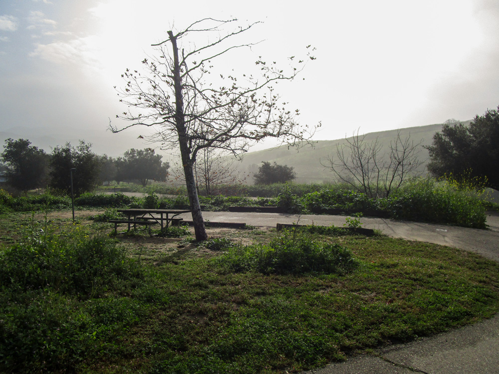
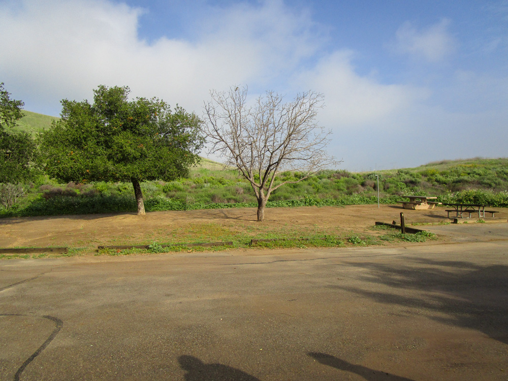
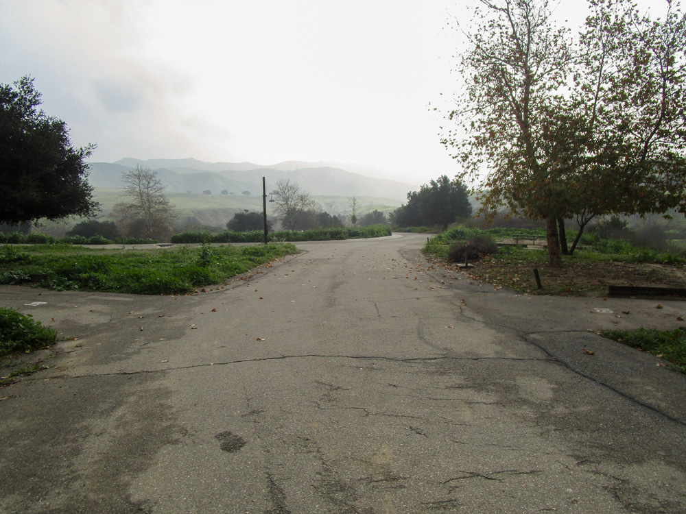
THE CAMPGROUND BATHROOM
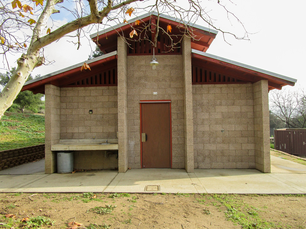
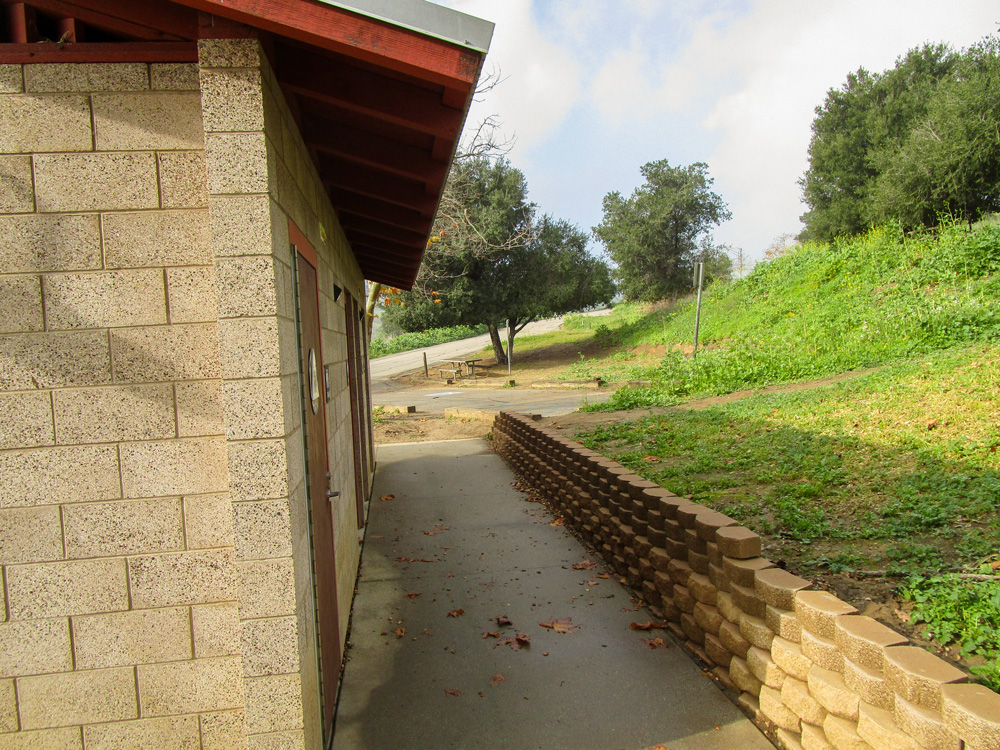
THE BARN
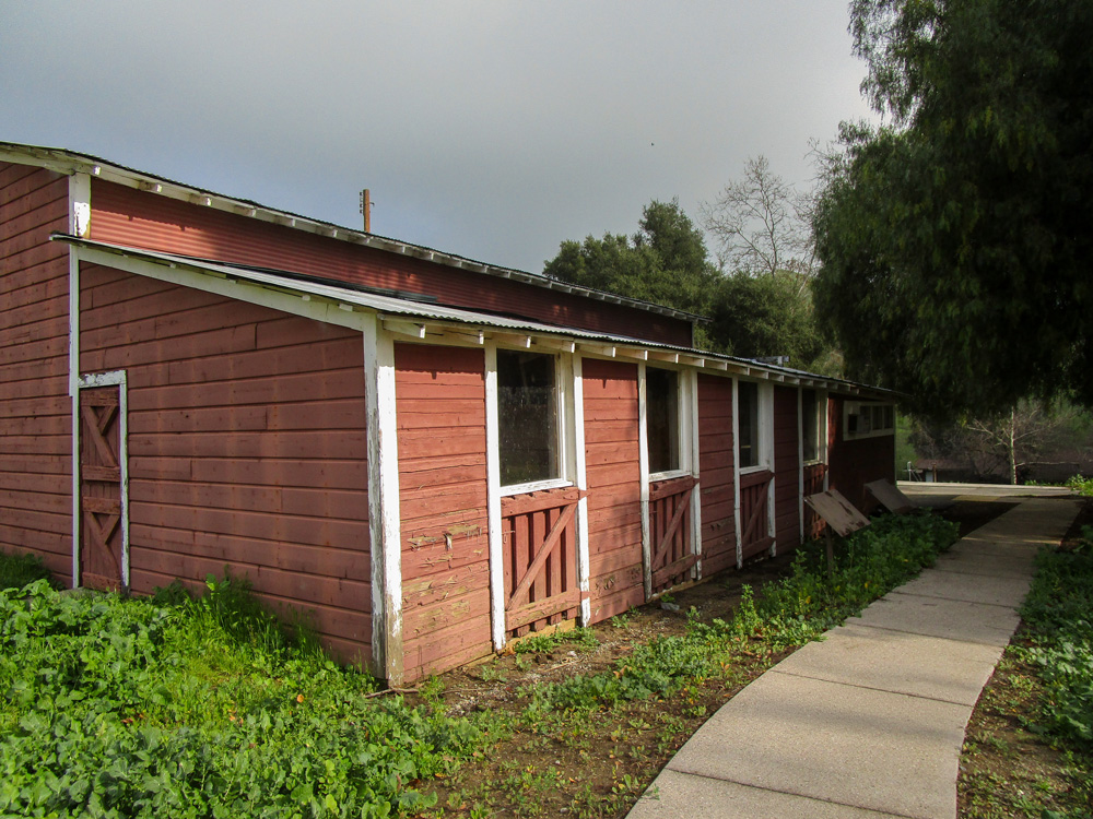
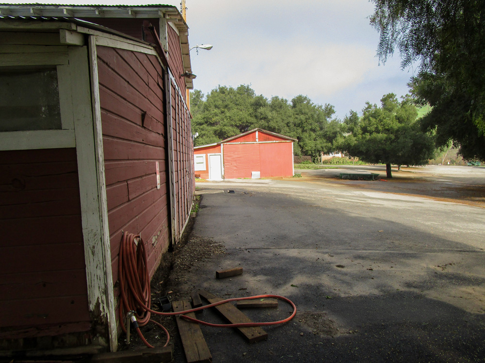
THE OLINDA FUELBREAK
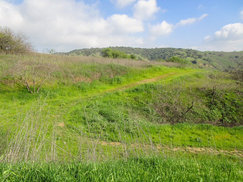
MISCELLANEOUS
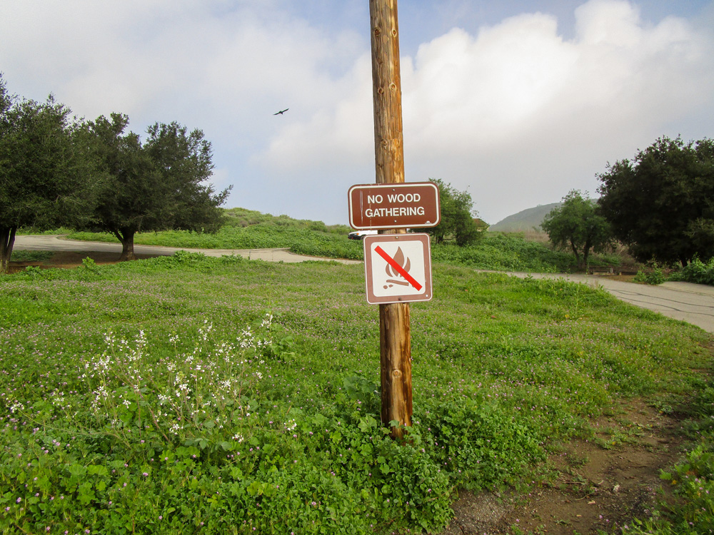
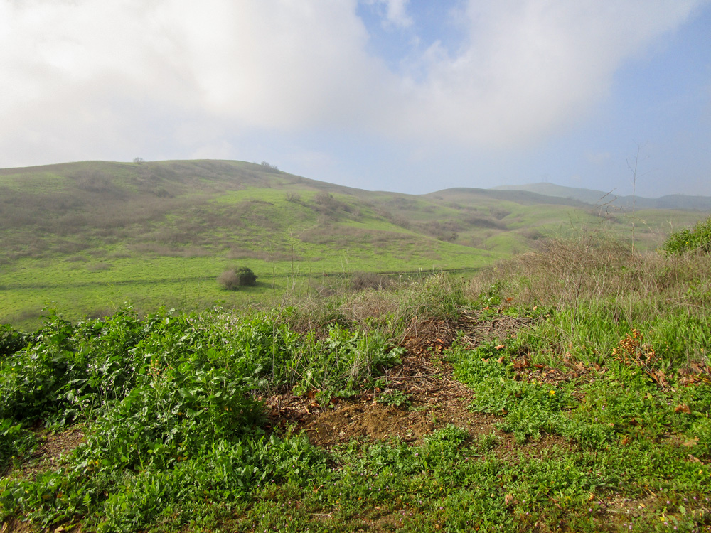
Our Team Visited the Park Again In May 2026
THE CAMPGROUND
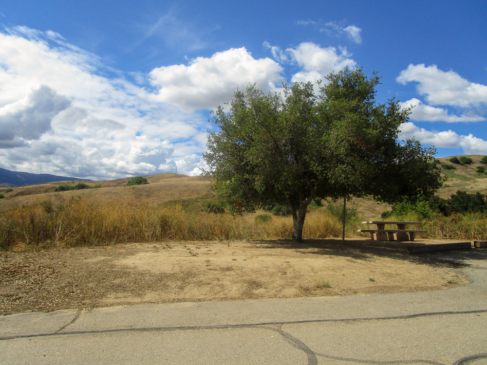
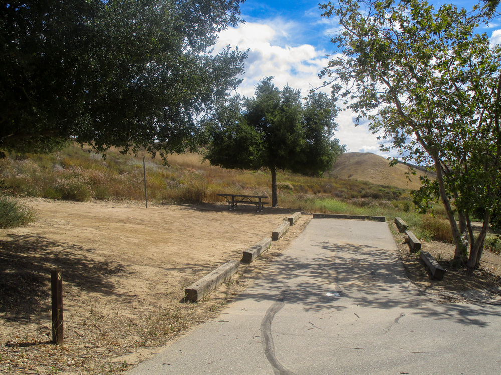
THE CAMPGROUND BATHROOM
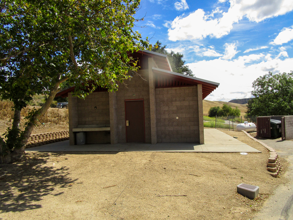
THE BARN
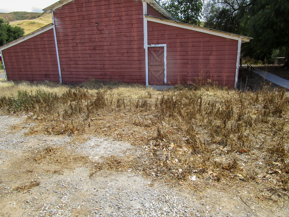
THE OLINDA FUELBREAK
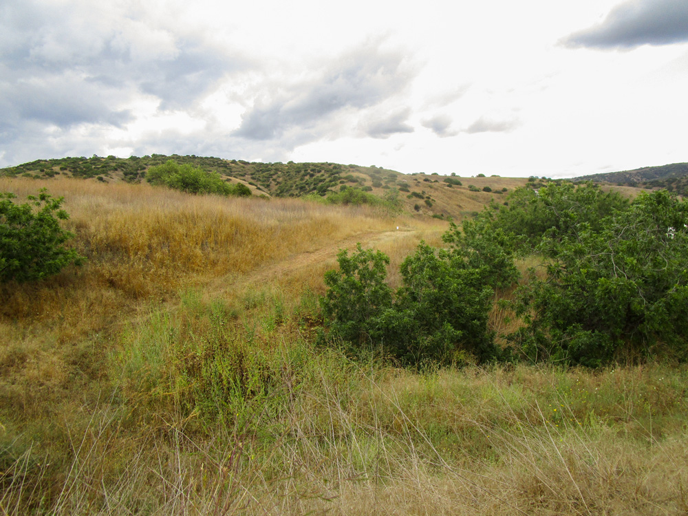
THE HORSE CAMP
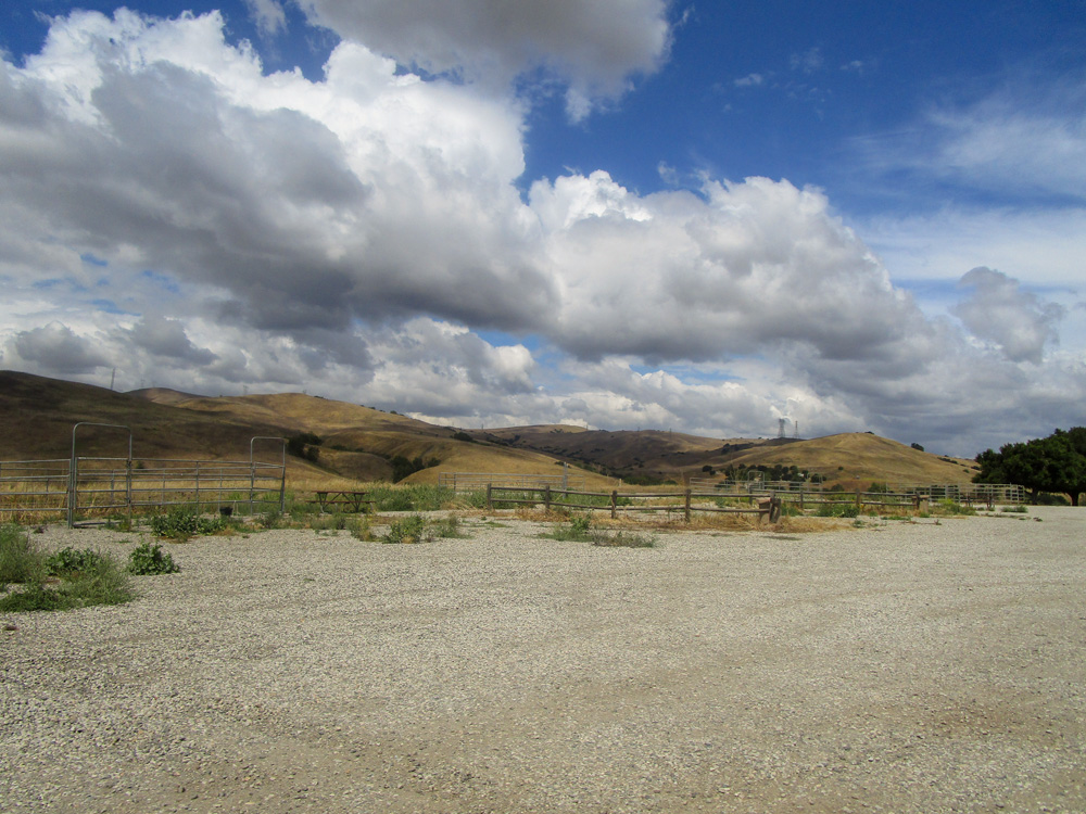
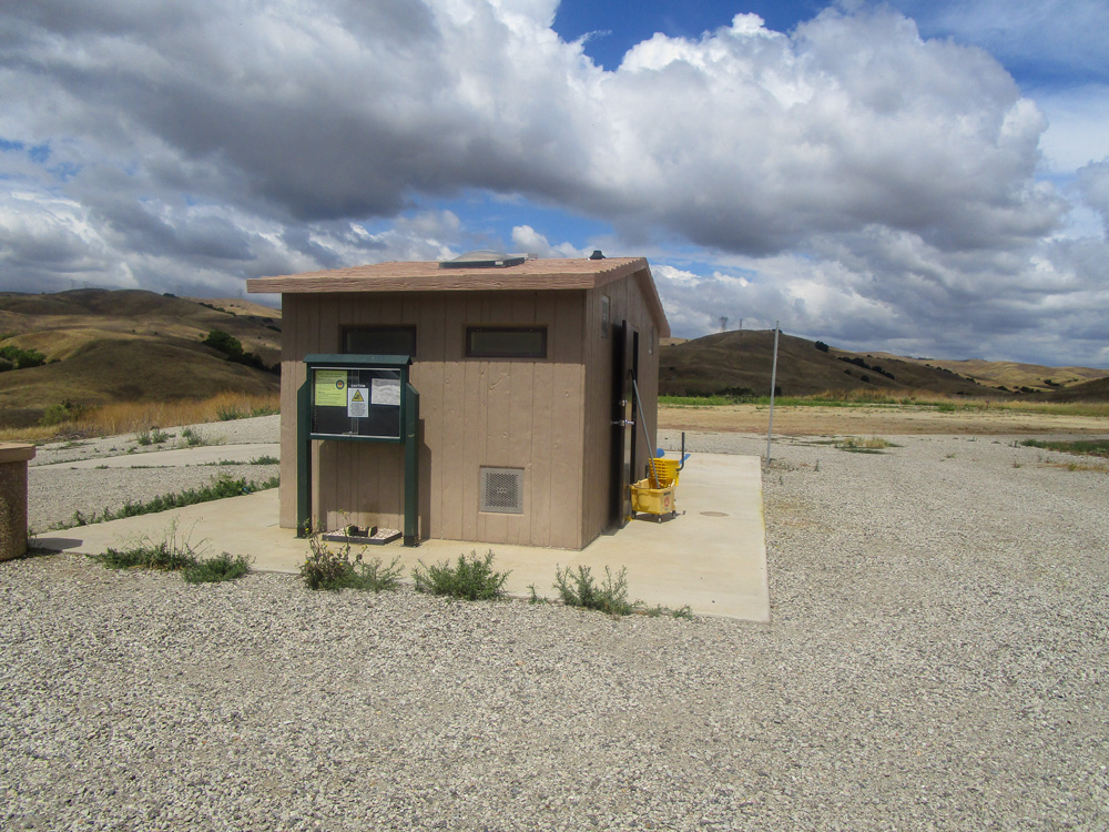
THE DISCOVERY CENTER
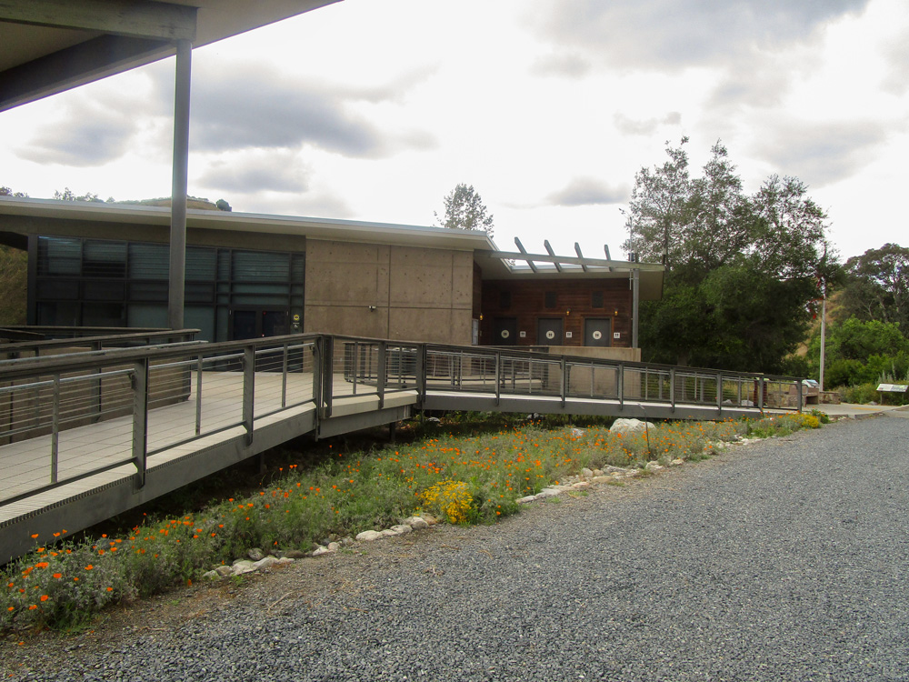
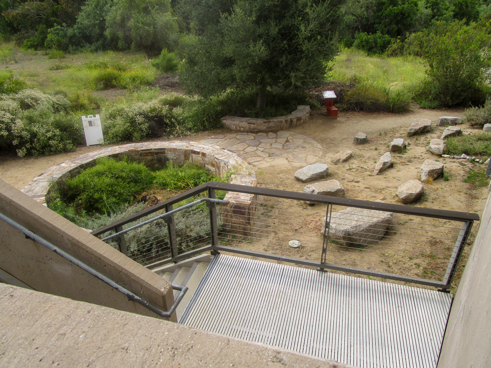
TRANSMISSION LINES
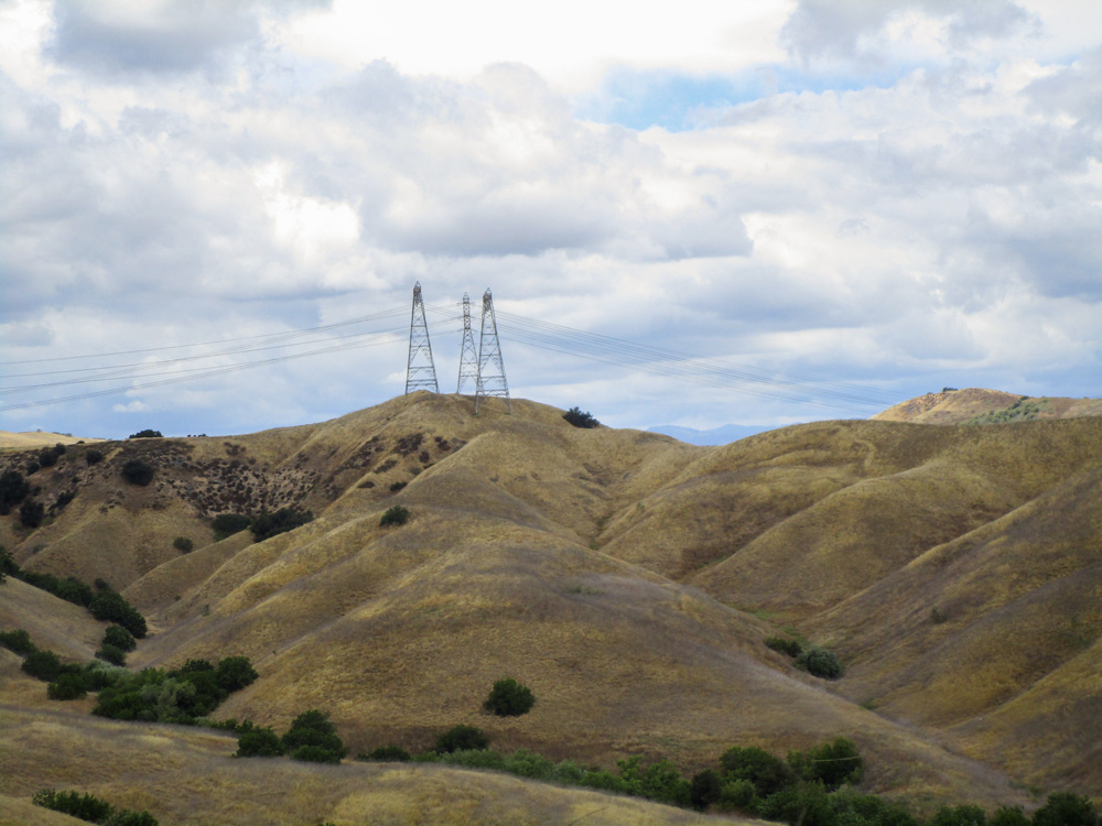
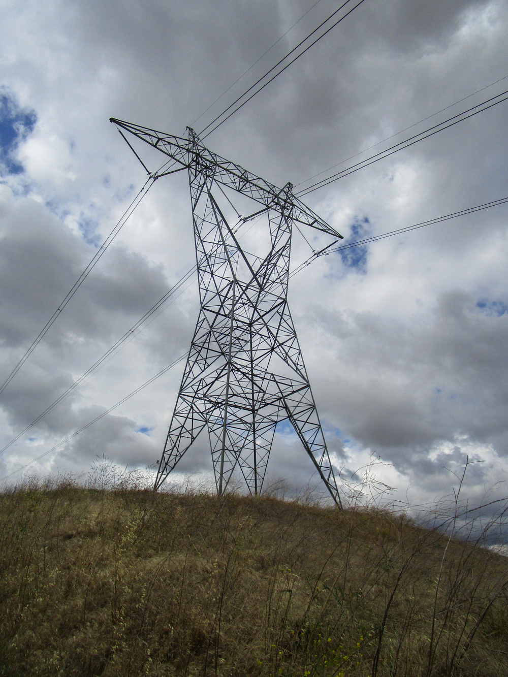
MISCELLANEOUS
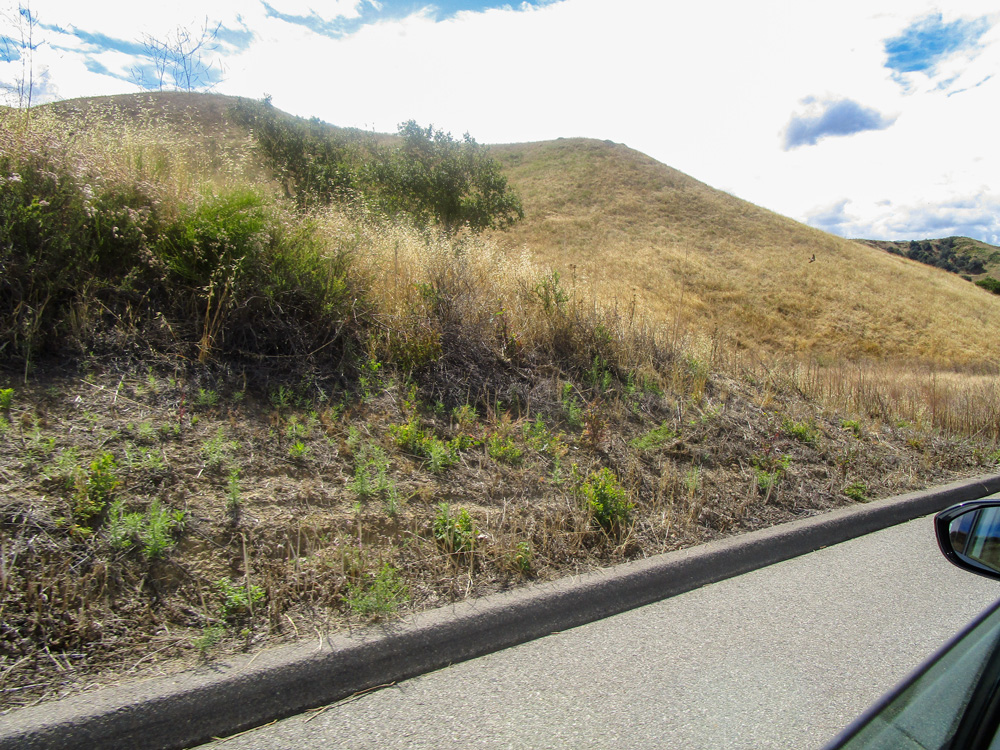
Source: Auditor observation.
Note: Some images contain sensitive information that has been redacted.
Appendix A features approximately twenty-two photos of Chino Hills State Park and some of its features taken by the audit team in January and May of 2026. The first half of photos reside under text stating, “Our Team Visited the Park in January 2026.” The first three photos are labeled, “The Campground.” Photo 1 features a thin road, a tree, and a picnic table, surrounded by green grass or shrubbery. There is a hill in the background. Photo 2 appears to be taken from a road and features two picnic tables and two trees. The ground appears to be clear of plants. Photo 3 is a picture of the road taken from the middle. The road appears maintained and to its left and right are trees and green grass. In the distance, there are hills. The next two photos are captioned, “The Campground Bathroom.” Photo 4 pictures the bathroom structure from outside. The bathroom appears to be concrete, with ventilation between the body of the structure and the roof. The structure sits on top of a small, paved area. Photo 5 is a picture taken from the side of the structure; it shows there is a walkway of concrete between the bathroom doors and a small brick wall separating the bathroom from a green, grassy patch of land. The next two photos are labeled, “The Barn.” Photo 6 is a photo of a red barn, with a thin strip of green grass between the barn and a paved walkway. The photo also features a large, leafy tree close to the barn. Photo 7 features a different angle of the barn; this side of the barn appears to be surrounded by concrete. There is an accompanying red structure nearby. The next photo is captioned, “The Olinda Fuelbreak.” Photo 8 features what appears to be a hill side covered in green grassland and chapparal or shrubbery. There is a thin trail-like, dirt path cutting through the grass, which is referred to as the Olinda Fuelbreak. The next two photos are captioned, “Miscellaneous.” Photo 9 features a pole with two signs. The first sign reads, “no wood gathering.” The second sign is a crossed out photo of a campfire, indicating that campfires are not allowed. The pole sits within a green, grassy area. A thin road curves through the park in the background. Additionally, there are multiple trees in the background. Photo 10 pictures a green hillside. In the foreground, there appears to be grassland. On the hill in the background, there appears to be chaparral. The second half of photos reside under text stating, “Our Team Visited the Park Again in May 2026.” The first two photos are captioned, “the campground.” Photo 11 appears to be taken from a road and features a picnic table shaded by a green, leafy tree. The immediate area around the tree and table is clear of debris and appears to be dry dirt. The area surrounding the dirt area features a hillside covered in tall, dry-yellow grass. Photo 12 also appears to be taken from the road. The photo pictures another campground area with a clear, dirt area with a picnic table and a tree. Like the last photo, there is a hill in the background with dry, yellow grass. The next photo is captioned, “the campground bathroom.” Photo 13 shows the bathroom structure which is concrete with ventilation between the body of the building and roof. Unlike the photo of the bathroom from January 2026, the area surrounding the bathroom and its paved base appears to be free of any grass. The next photo is captioned, “the barn.” Photo 14 features the side of the red barn. It shows that the barn is now surrounded by dry, yellow grass and shrubbery, with the shrubbery being much shorter in the area closest to the barn. The next photo is captioned, “the Olinda Fuelbreak.” Photo 15 features a hillside covered in mostly yellow, dry looking grass and shrubbery. There are some green bushes in the area. There is a trail-like, dirt path cutting through the hillside. The next two photos are captioned, “the horse camp.” Photo 16 features a large area with gravel on the ground. There appears to be fencing for horses bordering the area. Some green shrubbery is seen on the edges of the area. In the background, there are yellow hills. Photo 17 features a small, tan structure situated on the gravel. It is surrounded by a small square of concrete. Some green plants are growing between the concrete and the gravel. The next two photos are labeled, “the Discovery Center.” Photo 18 features a picture of a wide building with many windows on a gravel road. The building’s entrance is elevated, with entrance ramps on both sides. There are sparse flowers surrounding the ramps. Photo 19 is a photo taken from the back of the building featuring the area immediately behind the structure. A staircase down leads to a dirt area with various stones and a planter containing shrubbery. Behind the area is an area with green grass, shrubbery, and trees. The next two photos are captioned, “transmission lines.” Both photo 20 and 21 feature yellow hills with tall structures atop the hills, holding transmission lines. The last photo is labeled, “miscellaneous.” Photo 22 appears to be taken from a car window, and the car appears to be on a road. The photo features a roadside with a curb. On the other side of the curb, there is a yellow hill. The end of the appendix has a note stating, “Some images contain sensitive information that has been redacted.”
Appendix B
Comparison of Policies and Procedures in Chino Hills State Park’s Wildfire Management Plan to Guidance From State Parks Headquarters and the National Park Service
The Audit Committee asked us to identify Chino Hills State Park’s wildfire mitigation and fuel management policies and whether they align with key state wildfire prevention policies and plans. We identified standards and requirements relevant to wildfire resilience plans, including guidance from State Parks Headquarters’ wildfire management plan template and the National Park Service. We compared policies and procedures in the park’s wildfire management plan to the standards and requirements identified, as Table B shows.
Appendix C
Scope and Methodology
The Audit Committee directed the California State Auditor to conduct an audit of State Parks to determine the wildfire management practices at Chino Hills Park. Specifically, the Audit Committee asked us to identify the entities responsible for fuel management in the park, review how often these entities perform fuel management activities, and determine the standards on which the park’s fuel management policies and practices are based. The Audit Committee also asked us to identify the fuel management activities that occur in the area surrounding the park, determine which entities conduct these activities, and assess whether district staff coordinate with these entities. Finally, the Audit Committee asked us to determine which utilities have power lines in the park and which entities are responsible for ensuring the completion of adequate fire prevention activities for energy infrastructure in a timely manner. Table C lists the objectives that the Audit Committee approved and the methods we used to address them. Unless otherwise stated in the table or elsewhere in the report, statements and conclusions about items selected for review should not be projected to the population.
Assessment of Data Reliability
The U.S. Government Accountability Office, whose standards we are statutorily obligated to follow, requires us to assess the sufficiency and appropriateness of the computer-processed information we use to support our findings, conclusions, or recommendations. In performing this audit, we relied on electronic data files that we obtained from State Parks, the European Space Agency, CAL FIRE, the U.S. Census Bureau, and SCE. Specifically, we used the data from these sources to create maps depicting Chino Hills State Park; the Inland District; the neighboring cities, counties, suppression agencies, and landowners; the vegetation types in the park; the fire history of the park; the severity zones in the park; and the powerlines that cross through the park. We also used this data to approximate the amount of land with housing within two kilometers from Chino Hills State Park’s boundaries that is adjacent to or interspersed in wildland vegetation. Although we recognize that there may be limitations that affect the precision of the data we present, our findings and conclusions do not require these data; we have therefore determined that there is sufficient evidence in total to support our audit findings, conclusions, and recommendations.
Response
California Department of Parks and Recreation
July 22, 2026
Grant Parks
California State Auditor
621 Capitol Mall, Suite 1200
Sacramento, CA 95814
Dear Mr. Parks:
Department of Parks and Recreation Response
The California Department of Parks and Recreation (State Parks) appreciates the opportunity to comment on this report on wildfire resilience activities at Chino Hills State Park. The Department recognizes the considerable effort undertaken to understand the operational context, management policies, and ecological conditions that influence wildfire resilience within the State Park System.
We recognize that Chino Hills State Park sits at the intersection of multiple jurisdictions and communities in the Inland Empire, and that this setting heightens the importance of clear roles, shared standards, and sustained collaboration around wildfire resilience. State Parks is committed to working with the Legislature, state and federal partners, local governments, and other stakeholders to ensure that fire prevention practices in and around the park align with California’s broader Wildfire and Forest Resilience Action Plan and expectations for public safety.
We appreciate that the audit underscores both the ecological significance of Chino Hills State Park and the growing wildfire risks in the surrounding region. The report’s focus on fuel modification responsibilities, defensible space near communities, and coordination among State Parks, counties, cities, utilities, and federal partners mirrors concerns raised by residents, local officials, and conservation organizations in recent years. We agree that clarifying who does what, at what intervals, and under which standards is essential to ensuring that firefighting personnel can operate safely and effectively when a wildfire occurs.
The Department offers the following responses to the specific recommendations:
Documentation of Wildfire Resilience Activities
The Department agrees that maintaining consistent documentation of wildfire resilience activities is beneficial and will evaluate opportunities to improve documentation practices across districts. In doing so, the Department will consider methods that accurately capture the broad range of wildfire resilience work performed by park staff while recognizing that these activities are documented through multiple maintenance, natural resource management, project management, and operational processes, rather than solely through Wildfire Management Plans.
Public Reporting
The Department agrees that improving public communication regarding wildfire resilience efforts could enhance transparency and public understanding. The Department will evaluate opportunities to periodically summarize statewide wildfire resilience activities using information derived from existing operational and maintenance reporting systems while balancing the administrative effort required to produce such reports with available staffing resources.
Wildfire Management Plans
State Parks’ Wildfire Management Plans are fundamentally intended to form the basis for a “Local Operating Agreement” to guide State Parks and partnering fire suppression agencies in responding to, and recovering from, wildland fires. While the Chino Hills WMP summarizes broad categories of resource management that park staff undertake to prepare for wildland fires, the WMP is centered on the operational elements including defining roles and responsibilities and providing relevant information about the park to responding fire agencies. ① WMPs are one component of a broader management framework that includes specific plans such as vegetation management plans used to describe park vegetation, quantify vegetation management goals and describe techniques to meet those goals; or facilities management plans which describe the siting and management of park structures, trails and other elements of the built environment. The Department agrees that Wildfire Management Plans should continue to evolve as conditions, science, and best management practices develop. As these plans are updated and evolve, the Department will continue incorporating the best available science, ecosystem-specific management practices, and coordination with partner agencies while maintaining the appropriate role of WMPs within the Department’s broader resource management framework.
Workforce Analysis and Budget Change Proposal
The Department will analyze workforce needs at the district and may consider options to augment resources at the district, which may include a budget change proposal (BCP). However, the Department notes any BCP would need to be considered by control agencies within the context of the State’s overall fiscal condition and statewide priorities at that time, rather than based solely on the needs of a single park district.
Coordination with Local Fire Agencies and Jurisdictions
② The Department agrees that continued coordination with CAL FIRE, local fire agencies, and neighboring jurisdictions is valuable and notes that districts already maintain regular coordination through cooperative agreements, project development, emergency response planning, and ongoing operational relationships. The Department will evaluate opportunities to further formalize recurring coordination where appropriate while recognizing that the frequency and nature of these interactions should remain flexible and responsive to local conditions, wildfire risk, and available staffing resources.
Sincerely,
Kelly Elliott
State Park Superintendent
Comments
California State Auditor’s Comments on the Response From the Department of Parks and Recreation
To provide clarity and perspective, we are commenting on the response to our audit report from the Department of Parks and Recreation (State Parks). The numbers below correspond with the numbers we have placed in the margin of State Parks’ response.
① State Parks’ response incorrectly infers that the Wildfire Management Plan for Chino Hills State Park is intended to only be a summary document that principally defines the roles and responsibilities of agencies responding to a fire, and is not intended to define specific, actionable wildfire suppression goals or activities. We disagree. As we show in Table 2, State Parks’ Wildfire Management Plan template recommends that park plans include a wildfire preparedness section describing the wildfire preparedness goals and objectives for the park. Chino Hills State Park’s plan does not include this section. This omission coupled with a lack of consistent documentation demonstrating how frequently State Parks engages in wildfire resilience activities—such as vegetation management—creates uncertainty over the scope and efficacy of State Parks’ wildfire prevention activities. As a result, we recommend that State Parks update Chino Hills State Park’s Wildfire Management Plan to reflect relevant best practices and document its specific wildfire resilience activities and include a process for supervisors to validate that required activities were performed as expected.
② In its response, State Parks asserts that districts maintain regular communication with other entities, as we note. However, we found that while Inland District staff have attended various meetings with other agencies in the last three years, State Parks could not demonstrate that these meetings constituted required meetings with local suppression agencies. Additionally, we note that Inland District staff have not held or attended the interagency wildfire planning meeting with CAL FIRE. Thus, we recommend that Inland District staff ensure that the meetings prescribed in Chino Hills State Park’s Wildfire Management Plan and the Statewide Interagency Agreement occur annually.
Footnotes
- Amanda R. Carlson et al., “Rising Rates of Wildfire Building Destruction in the Coterminous United States,” PNAS, Vol. 33, No. 51, December 2025, www.pnas.org/doi/10.1073/pnas.2505886122, accessed on May 18, 2026. Daniel Swain et al., “Increasing Hydroclimatic Whiplash Can Amplify Wildfire Risk in a Warming Climate,” Global Change Biology, January 2025. ↩︎
- Heather Anu Kramer et al., “High Wildfire Damage in Interface Communities in California,” International Journal of Wildland Fire, July 2019, research.fs.usda.gov/download/treesearch/58348.pdf, accessed on May 18, 2026. ↩︎
- Jon Keeley and Alexandra Syphard, “Historical patterns of wildfire ignition sources in California ecosystems,” International Journal of Wildland Fire, November 2018, https://connectsci.au/wf/article/27/12/781/21392/Historical-patterns-of-wildfire-ignition-sources, accessed on May 19th, 2026. ↩︎
- We observed some power lines and poles in the park but did not approximate line or pole clearance for every overhead power line in the park and therefore cannot conclude that every power line in the park met State requirements. ↩︎
- In 2025, amendments to state law made Energy Safety’s review of an electrical corporation’s adherence to its wildfire mitigation plan a performance-based assessment. ↩︎
- ALERT California is a public safety program that manages monitoring cameras and sensors. The program works with federal, state, and local agencies to provide access to the program’s camera network and technology to provide real‑time data. ↩︎
- Chelsea L. Andreozzi et al., “Southern California Regional Profile,” February 2023, wildfiretaskforce.org/wp-content/uploads/2023/08/SoCal_RegionalProfile_Updated_Aug2023.pdf, accessed on February 19, 2026. ↩︎